
What is recorded here
In rough pasture, located on a prominent rise, from which there is a steep fall of ground to the River Deel which lies 55m to S and marks the townland boundary. The location overlooks a bend in the river, and there are excellent views to SE and SW along the river valley. Named ‘Rathglass’ on the 1838 and 1922 OS…
Read the whole record
From the National Monuments Service (Archaeological Survey of Ireland) record MA038-044002
Places near here
Photo credits
- Maker not stated on source page, commons.wikimedia.org
- National Inventory of Architectural Heritage
- Maker not stated on source page, fity.club
- Maker not stated on source page, www.tonyoneill.org
- Maker not stated on source page, nl.pinterest.com
- Maker not stated on source page, en.wikipedia.org
- Maker not stated on source page, www.lonelyplanet.com
- David Farrell Photography / Western People, www.westernpeople.ie
- Connaught Telegraph; photographer not named, www.con-telegraph.ie
 Fairy fort / earthen ringfort in BallinlabaunFairy fort / earthen ringfort · 1045 yd
Explorer Tom Fairy fort / earthen ringfort in Ballinlabaun gave up its stones for Lent, but kept the shape. It’s an oval on a ridge…
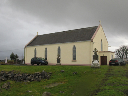 Catholic Church of Our LadyChurch/chapel · 1419 yd
Explorer Tom Catholic Church of Our Lady in Kilmurry More is telling a ridiculous smuggling story about cheese hidden inside the…
 Stone head in Kilmurry MoreStone head · 1451 yd
Explorer Tom Stone head in Kilmurry More is wedged in concrete at the graveyard entrance, looking like it wants to escape but can't…
 Wedge tomb in Carrowgarve SouthWedge tomb · 1.2 mi
Explorer Tom Wedge tomb in Carrowgarve South claims it took exactly four hundred cups of tea to build, which is either a lie or a…
 Megalithic tomb in CreevyMegalithic tomb · 1.2 mi
Explorer Tom Megalithic tomb in Creevy has a family tree that is mostly made up by me right now because nobody else will answer for…
 Holy well in Carrowgarve SouthHoly well · 1.4 mi
Explorer Tom Holy well in Carrowgarve South took forty cups of tea to build, according to the local legend that is definitely true.…
 Standing stone in Carrowkilleen (tirawley By.)Standing stone · 1.7 mi
Explorer Tom Standing stone in Carrowkilleen has a curse that only hits people who don’t wave to the cows. It’s on a hilltop, so you…
 Court tomb in Carrowkilleen (tirawley By.)Court tomb · 1.8 mi
Explorer Tom Court tomb in Carrowkilleen thinks Dublin tourists are too loud for its ancient peace. It’s the eastern twin, always…
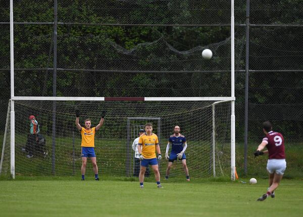 St. Tiernan's Park, Crossmolina Deel RoversGAA ground · 2.6 mi
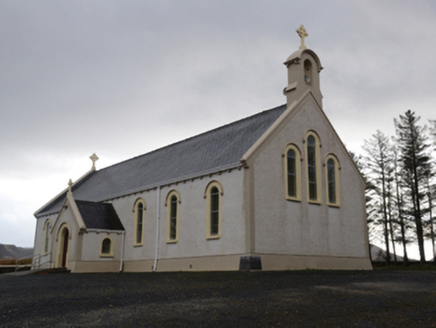 Catholic Church of the Holy SoulsChurch/chapel · 5.2 mi
Explorer Tom Catholic Church of the Holy Souls in Keenagh Beg claims it’s older than the concept of silence itself. The architects…
 Ardagh, Ardagh GAAGAA ground · 5.2 mi
 Doon Castle (in ruins)Castle, unclassified · 20 mi
Explorer Tom Doon Castle would use a lotto win to buy a very large, very comfortable hat. It’s tired of looking like a bald eagle…
More archaeology and monuments in County Mayo · All of County Mayo

What do you know about this place?Tap to add a comment or ask a question