
What is recorded here
In undulating pasture, on a natural rise and densely covered with undergrowth and trees. The natural rise is utilised to form a high flat-topped circular platform (24.6m NW-SE) defined on top by an earthen bank (Wth 3m; int. H 0.5m; ext. H 4.8m) S-N and by a scarp N-S. A tumble of loose stones was noted on the…
Read the whole record
From the National Monuments Service (Archaeological Survey of Ireland) record SL025-071001
Places near here
Photo credits
- National Inventory of Architectural Heritage
- Maker not stated on source page, www.tripadvisor.com
- Maker not stated on source page, www.alamy.com
- Maker not stated on source page, ru.pinterest.com
- Maker not stated on source page, de.wikipedia.org
- Maker not stated on source page, www.pinterest.com
- Djedi Guy, Wikimedia Commons · CC BY-SA 4.0
- Maker not stated on source page, irisharchaeology.org
- Kmcnamee, Wikimedia Commons · CC BY-SA 4.0
- Zxcode / Wikimedia Commons, commons.wikimedia.org
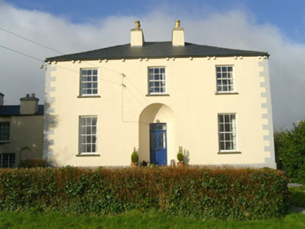 Rathbarran HouseRectory/glebe/vicarage/curate's house · 108 yd
Explorer Tom Rathbarran House in Rathbarran is showing off its deeply recessed door like it’s hiding a secret from the whole parish.…
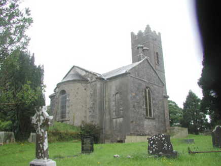 Killoran ChurchChurch/chapel · 208 yd
Explorer Tom Killoran Church in Rathbarran has a long grudge against the weather because it keeps trying to wash away its splayed…
 Fairy fort / earthen ringfort in RathgranFairy fort / earthen ringfort · 1373 yd
Explorer Tom Fairy fort / earthen ringfort in Rathgran would survive a zombie attack by simply rolling over them with its heavy…
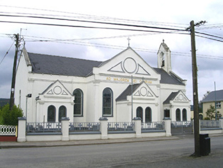 Catholic Church of the Sacred Heart and Saint JosephChurch/chapel · 1.1 mi
Explorer Tom The Catholic Church in Shancough is getting picked on by the wind because it stands out a bit too much for its own…
 Fairy fort / earthen ringfort in BallymurrayFairy fort / earthen ringfort · 1.5 mi
Explorer Tom Fairy fort / earthen ringfort in Ballymurray thinks Dublin tourists are just people who got lost on purpose to look…
 Kilvarnet CemeteryCemetery · 1.8 mi
Explorer Tom When nobody is looking, Kilvarnet Cemetery probably reorganizes its headstones by height like some weird garden club.…
 Court tomb in BallymurrayCourt tomb · 1.9 mi
Explorer Tom Court tomb in Ballymurray: It deeply suspects the postman is stealing its stones one by one, though it’s only lost half…
 Fairy fort / earthen ringfort in Ballynacarrow NorthFairy fort / earthen ringfort · 2.0 mi
Explorer Tom Fairy fort / earthen ringfort in Ballynacarrow North is the northeastern one of three, cut off by a field boundary that…
 Catholic Church of Saint Fechin and Saint LassaraChurch/chapel · 2.3 mi
Explorer Tom Catholic Church of Saint Fechin has a bird that refuses to leave the bellcote for reasons unknown. The timber truss…
 Bullaun stone in Lecarrow (corran By., Owenmore Ed)Bullaun stone · 4.5 mi
Explorer Tom Bullaun stone in Lecarrow has a family tree that is ninety percent made up by my uncle, who swears his…
 Nace O'Dowd Park, Coolaney/Mullinabreena GAAGAA ground · 4.6 mi
 Owenmore Gaels GAA pitchGAA ground · 5.0 mi
More archaeology and monuments in County Sligo · All of County Sligo

What do you know about this place?Tap to add a comment or ask a question