DDiscover AloneMapAbout

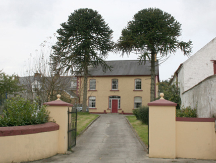
Railway station in Moyle

Railway station
Railway station in Moyle
Photo: National Inventory of Architectural Heritage · Report the wrong picture

This does not grant access. Most recorded buildings are privately owned; view them only from public ground unless the owner allows entry.

Recorded change of use
Originally railway station; recorded by the architectural inventory as house
What do you know about this place?Tap to add a comment or ask a question

What you write will be public.

What is recorded here

Detached three-bay two-storey former railway station, built c. 1883. Now in use as a private house (line closed 1953) with later single-bay single-storey porch extension to centre of the front elevation (north-east), and later extensions to the rear (south-west) and to the north-west gable end. Pitched artificial…

Read the whole record
Detached three-bay two-storey former railway station, built c. 1883. Now in use as a private house (line closed 1953) with later single-bay single-storey porch extension to centre of the front elevation (north-east), and later extensions to the rear (south-west) and to the north-west gable end. Pitched artificial slate roof (fibre cement) having exposed decorative rafter ends to eaves, grey clay ridge tiles , smooth rendered chimneystacks to gable ends (north-west and south-east) with red clay pots over, decorative timber bargeboards to gables with trefoil perforations, and with metal rainwater goods. Smooth rendered ruled-and-lined walls over smooth rendered plinth course with a horizontal smooth rendered band running around building to upper floor, and with moulded rendered stringcourse at ground floor level brought over window heads as architrave. Square-headed window openings with smooth rendered reveals, painted stone sills, and with one-over-one pane horned timber sliding sash windows having margin glazing bars; timber casement window with margin glazing bars to central bay of front elevation (north-east) at first floor level. Central square-headed door opening to front elevation with smooth rendered reveals, replacement timber double-doors, and original square-headed sidelights with margin glazing bars, all enclosed within modern porch. Set back from road with gravel drive running to roadway to the north-east. Garden to the front of site and garage to rear (south-west) built partially over site of former railway line. Former railway water tower (see 40824014) to the north-west. Located in the rural countryside to the north-west of Newtowncunningham.
This handsome and well-proportioned former railway station, originally built in 1883, retains much of its original form and character despite some modern alterations and additions. Its visual appeal is enhanced by the retention of salient fabric such as the timber sliding sash windows with margin glazing bars. The front elevations is enlivened by the subdued render detailing particularly by the moulded render stringcourse at ground floor level that is brought over window openings as architraved surround. The exposed rafter ends and the pierced timber bargeboards with trefoil perforations help to add some decorative interest at roofscape level. The construction of this building gives an idea of the quality of architecture seen in the development of the railways in the second half of the nineteenth century. This railway station was built as part of the Londonderry\Derry (Middle Quay) to Burtonport line, which was originally contrived by the Londonderry & Lough Swilly Railway Company. This section, Burt Junction to Letterkenny, was opened in June 1883 by the Letterkenny Railway Company; the Letterkenny to Burtonport section was opened later in March 1903 by the Letterkenny & Burtonport Extension Railway Company. This section of line (Burt Junction to Letterkenny) closed completely in 1953. This line was built to the 3ft narrow gauge. This former railway station is one of the better surviving examples of its type in Donegal, and now acts as an interesting historical reminder of the formerly extensive railway network in County Donegal, and is an integral element of the built heritage of the Newtowncunningham area and of the wider transport heritage of the county. It forms a pair of related sites with the former railway water tank (see 40824014 to the north of the site. There was formerly a large goods shed to the east of site, now demolished.

From the Buildings of Ireland (National Inventory of Architectural Heritage) record 40824013

Places near here

Photo credits
  • National Inventory of Architectural Heritage
  • Kenneth Allen, Geograph · CC BY-SA 2.0
  • Joe Boland / North West News Pix, via Donegal Daily, www.donegaldaily.com
  • Maker not stated on source page, pl.pinterest.com
  • Maker not stated on source page, www.pinterest.com
  • Maker not stated on source page, www.welovedonegal.com
  • M'Loughlin, Peter, Wikimedia Commons
  • Maker not stated on source page, www.kinopoisk.ru
  • Maker not stated on source page, en.wikipedia.org
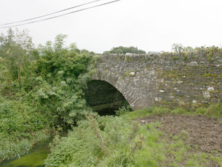
bridge231 yd

Explorer Tom Bridge in Glar is wearing its heavily overgrown eastern verge like a giant, itchy woolly scarf. I picture the grass…
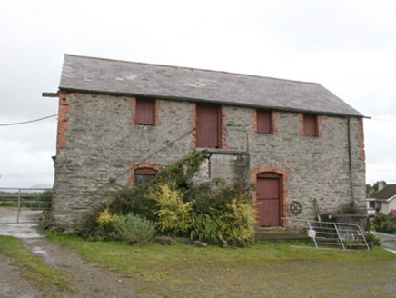
farm house, outbuilding497 yd

Explorer Tom Farm house, Outbuilding in Moylemoss has a door that refuses to be on the ground floor! Built around 1860, you have to…

Coyles barPub · 704 yd

Explorer Tom Coyles bar in County Donegal is probably hiding a secret stash of old pints behind the tap. I bet they serve a stout…
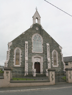
Newtowncunningham Presbyterian ChurchChurch/chapel · 708 yd

Explorer Tom Newtowncunningham Presbyterian Church is the kind of place that brings its own dramatic lighting to any party. It’s got…

Páirc Cholm Cille, Naomh Colmcille GAA, NewtowncunninghamGAA ground · 875 ydfarm house1144 yd

Explorer Tom Farm house in Ardee is suspicious of the postman because he always leaves the letter on the porch without knocking.…

Holy well in KillyverryHoly well · 1612 yd

Explorer Tom Holy well in Killyverry appears in a school folklore account that links St Mary's well to a belief about sprain cures.…

Standing stone in NewtowncunninghamStanding stone · 1664 yd

Explorer Tom Standing stone in Newtowncunningham is a solid 1.63m high, wedged between boulders and slabs that look like they were…

CastleCastle, motte · 1.7 mi

Explorer Tom Castle is a sub-rectangular natural mound, deliberately chopped up by a western fosse to look like something more…

O'Doherty's CastleRuins · 1.9 mi

Explorer Tom O'Doherty's Castle near Burt is the one that can make a confident guide point towards Buncrana and get the wrong ruin…

Maylin WoodOfficial walking route · 1.9 mi

Explorer Tom Maylin Wood is Donegal's reminder that a good outing does not need to occupy half a calendar. This small loop near…

Burt Church GraveyardGraveyard · 2.0 mi

Explorer Tom Burt Church Graveyard has a church whose eastern nine metres became the Fergusson family's burial plot, probably in the…

More historic places in County Donegal · All of County Donegal

Add to this placeAdd a picture Add a detailed tip Add a story

Explore the map1,095,414 places to discover

Next place · or swipebridge