
What is recorded here
Single-arched bridge carrying road over small unnamed river\stream draining into Lough Swilly to the north, built c. 1800. Segmental-headed arch with roughly dressed stone voussoirs; rubble stone construction to arch barrel with modern reinforced concrete underpinning. Rubble stone construction to spandrels and…
Read the whole record
From the Buildings of Ireland (National Inventory of Architectural Heritage) record 40824016
Places near here
Photo credits
- National Inventory of Architectural Heritage
- Kenneth Allen, Geograph · CC BY-SA 2.0
- Kenneth Allen, Wikimedia Commons · CC BY-SA 2.0
- Alistair Cunningham, Wikimedia Commons · CC BY 3.0
- Oliver Dixon, Wikimedia Commons · CC BY-SA 2.0
- Wanfried-Dublin, Wikimedia Commons · CC BY-SA 4.0
- P L Chadwick, Wikimedia Commons · CC BY-SA 2.0
- N Chadwick, Geograph · CC BY-SA 2.0
- Eeno11, Wikimedia Commons · CC BY-SA 3.0
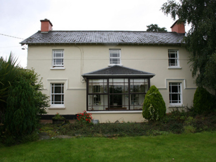 railway station231 yd
Explorer Tom Railway station in Moyle was built back in 1883 and it’s still looking rather handsome despite some modern tweaks. The timber windows with margin glazing bars are a real treat to see. Imagine the clatter of trains passing by all those years ago!
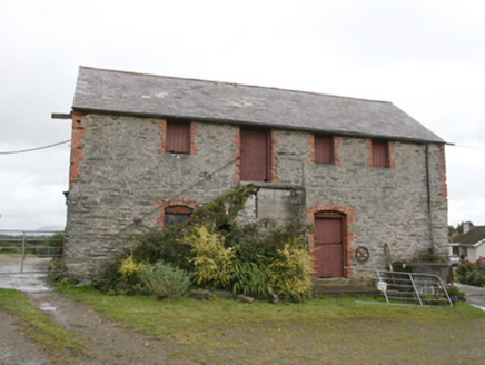 farm house, outbuilding688 yd
Explorer Tom Farm house, Outbuilding in Moylemoss has a door that refuses to be on the ground floor! Built around 1860, you have to climb these stone steps just to get inside. I bet someone decided the kitchen needed to be up there because they were afraid of mud.
 Coyles barPub · 900 yd
Explorer Tom Coyles bar in County Donegal is probably hiding a secret stash of old pints behind the tap. I bet they serve a stout that tastes like it’s been marinating in peat for decades. Grab me a pint if you’re passing through!
 Burt CastleCastle, tower house · 1.9 mi
Explorer Tom Burt Castle's roofless keep still stands on the hill, with two round corner towers and rows of gun-loops. The old account even records a spiral stair with broken steps in the south-west tower. I would admire that stubborn stonework from safe ground; those steps sound like trouble.
 When Balor Came West: The Second Battle of Mag TuiredMythic battle remembrance · 3.0 mi
Explorer Tom When Balor Came West: The Second Battle of Mag Tuired sits on flat ground below Aileach, relying entirely on Eochu Ollathair’s poem rather than archaeology. I suppose it is easier to argue with a rhyme than a shovel.
 Inch Castle Promontory FortPromontory fort, coastal · 3.7 mi
Explorer Tom Inch Castle Promontory Fort sits right on Farland Bank, which is a bit of a mystery since the records are silent. But that coastal edge? I bet the wind there has been roaring since ancient times, keeping the ghosts perfectly chilled.
 Old CastleCastle, tower house · 3.7 mi
Explorer Tom Old Castle is a stubborn tower house that has survived since 1454, even if Mr. Skinner never finished his rebuild. The east half stands three storeys high with intact vaults and murder holes, while the rest lies in ruins. It’s a proper cliff-edge survivor that refuses to fully crumble away.
 Carnaghan Portal TombPortal tomb · 4.5 mi
Explorer Tom Carnaghan Portal Tomb stands on Inch Island, watching over Lough Swilly with two tall stones framing its entrance. Locals call it the King’s Grave, and Fagan found crocks of bones nearby back in 1846. It’s a royal spot that still feels a bit mysterious and isolated.
 Our Lady of Lourdes ChurchCemetery · 4.5 mi
Explorer Tom Our Lady of Lourdes Church graveyard is where you go when you need to feel small but also slightly drunk. I bet the church bell rings specifically to scare off the birds that want to eat the headstones. Best seen with a hangover and a sausage roll.
 Grianán of AileachHeritage attraction · 4.5 mi
Explorer Tom Grianán of Aileach makes a splendid lookout above Inishowen, with both Lough Foyle and Lough Swilly in sight. I would bring my questions about kings and legends up the hill, but I would sort out the practical matter first: Heritage Ireland says there are no toilets.
 Greenan MountainMountain / peak · 4.5 mi
Explorer Tom Greenan Mountain is a peak in County Donegal with no recorded access details. The picture looks north towards Inch Island, which makes me think the mountain is just using it as a background for its own very serious portrait.
 Rowan4.5 mi
Explorer Tom Rowan in County Donegal is hiding because it thinks it wards off witches, but I'm pretty sure it just hates the rain. It needs permission to exist properly. Ask it politely if it wants a cup of tea.
More historic places in County Donegal · All of County Donegal

What do you know about this place?Tap to add a comment or ask a question