
What is recorded here
Situated on the summit of a N-S ridge. When first described in 1969 (SMR file) it presented as a large ring-barrow consisting of a circular grass-covered area (diam. 40m N-S; 39.5m E-W) separated by a fosse (Wth of top 6.5-7.5m; Wth of base 2-2.5m; int. D 0.6-0.7m; ext. D 0.8-0.9m) from an outer earthen bank (Wth of…
Read the whole record
From the National Monuments Service (Archaeological Survey of Ireland) record ME011-040
Places near here
Photo credits
- Maker not stated on source page, en.wikipedia.org
- Maker not stated on source page, www.gaia.com
- Maker not stated on source page, commons.wikimedia.org
- Maker not stated on source page, www.tripadvisor.ca
- Maker not stated on source page, uk.pinterest.com
- Maker not stated on source page, www.dreamstime.com
- National Inventory of Architectural Heritage
 Enclosure in RaffinEnclosure · 8 yd
Explorer Tom Enclosure in Raffin is sick of being asked if it’s haunted, because it isn't, it's just tired. It sits on a ridge…
Enclosure in ClooneyEnclosure · 1182 ydExplorer Tom Enclosure in Clooney is an oval cropmark sitting next to a pond, which makes me think it’s just a giant swimming pool…
 Fairy fort / earthen ringfort in RahoodFairy fort / earthen ringfort · 1604 yd
Explorer Tom Fairy fort / earthen ringfort in Rahood is playing hard to get. A tragic romance ended here, leaving only a muddy scarp…
 Fairy fort / earthen ringfort in Castletown (morgallion By.)Fairy fort / earthen ringfort · 1716 yd
Explorer Tom Fairy fort in Castletown was built on a bargain, probably involving three bags of potatoes and a promise that the bank…
 St Peter's Church (site of)Archaeological place · 1.1 mi
Explorer Tom St Peter's Church is the scene of a feud between two families over who owns the best view from the graveyard wall. It’s…
 St Peter's Church GraveyardGraveyard · 1.1 mi
Explorer Tom St Peter's Church Graveyard in County Meath gave up sugar for Lent but ended up eating the whole cake anyway because…
 Stone CrossCross-slab · 1.1 mi
Explorer Tom Stone Cross in Drakestown has a dating profile that says 'ancient, mysterious, and slightly crooked.' It’s sitting on a…
 Drakerath CastleArchaeological place · 1.3 mi
Explorer Tom Drakerath Castle has a secret it would spill after three pints: it actually likes being an archaeological site more…
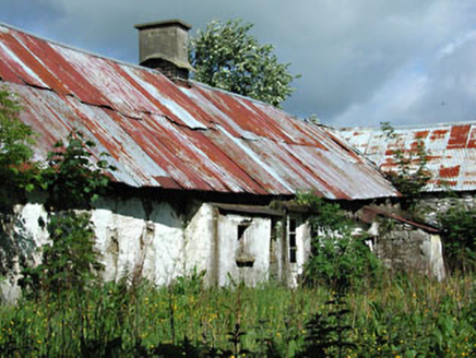 farm house1.5 mi
Explorer Tom Farm house in Castletown swears by a superstition where if you don’t wave at the cows, they won’t milk properly. It’s…
 Earthwork in SpiddalEarthwork · 1.6 mi
Explorer Tom Earthwork in Spiddal is secretly proud of its potato heritage, though nobody believes it. It’s just a bump pretending…
 TombTomb, chest tomb · 1.7 mi
Explorer Tom Tomb in Castletown thinks its favorite song is 'The Parting Glass' because it’s built into a tower wall and feels very…
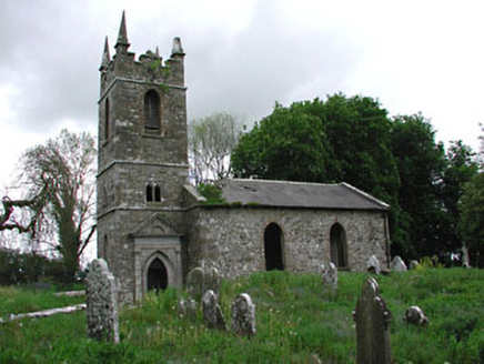 Saint Patrick's Church (Castletown)Church/chapel · 1.7 mi
Explorer Tom Saint Patrick’s in Castletown gave up chocolate for Lent but kept its medieval stone fragments just in case. It was…
More archaeology and monuments in County Meath · All of County Meath

What do you know about this place?Tap to add a comment or ask a question