What is recorded here
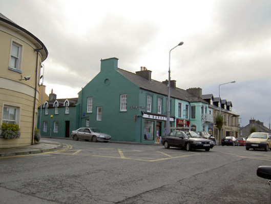
Corner-sited end-of-terrace three-bay two-storey house, built c. 1810, now also in use as shop with render shopfront to ground floor of front elevation, and having lower three-bay two-storey house slightly projecting from side elevation. Pitched slate roof to main block with rendered chimneystacks and cast-iron rainwater goods. Painted rendered walls, east gable having circular recessed panel with render surround. Square-headed openings throughout with six-over-six pane timber sliding sash windows, those to front elevation having moulded render surrounds. One window opening to east gable is margined one-over-one pane and lacking sill. Shopfront comprising render scroll console brackets and render architrave, fascia with raised render lettering and cornice. Square-headed replacement timber plate-glass display windows. Square-headed door opening with replacement timber door and overlight. Rear block has pitched slate roof with rendered chimneystack, cast-iron rainwater goods and pitched slate roofs to half-dormer first floor windows. Rendered walls and square-headed door and window openings, latter with two-over-two pane sliding sash windows.
This building occupies a prominent corner site on the Main Street of Millstreet. Its symmetrical façade and height are similar to the surrounding buildings, but its façade is distinguished by the decorative surrounds and its retention of timber sash windows. The shopfront adds context to the site, is well executed and of a variety unusual in the towns of Ireland today.
From the Buildings of Ireland (National Inventory of Architectural Heritage) record 20817009
This does not grant access. Most recorded buildings are privately owned; view them only from public ground unless the owner allows entry.
Places near here
Photo credits
- National Inventory of Architectural Heritage
- Jonathan Thacker, Geograph · CC BY-SA 2.0
- Eeno11, Wikimedia Commons · CC BY-SA 3.0
- Mike Searle, Wikimedia Commons · CC BY-SA 2.0
- Jonathan Thacker, Geograph · Creative Commons Attribution-ShareAlike 2.0
- Colin Park, Geograph · CC BY-SA 2.0
- User Coil00 on en.wikipedia, Wikimedia Commons · CC BY-SA 3.0
- Maker shown on the Wikimedia Commons file page · CC BY-SA 3.0
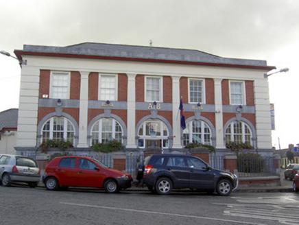 Allied Irish BankBank/financial institution · 49 yd
 J.a. HickieHouse · 53 ydMillstreet Tourist InformationVisitor information · 376 yd
 St. Patrick's ChurchVisitor information · 410 yd
 Rowan1656 yd
 Castle and TurretCastle, tower house · 1.3 mi
 Grave YardGraveyard · 1.3 mi
 Claragh MountainMountain / peak · 1.6 mi
 Kilmeedy CastleCastle, tower house · 1.7 mi
 CurracahillMountain / peak · 3.3 mi
 Glantane EastArchaeological place · 3.9 mi
 Battle of KnocknaclashyBattle · 5.6 mi
More historic places in County Cork · All of County Cork
What do you know about this place?