
Places near here
Photo credits
- National Inventory of Architectural Heritage
- Richard Webb, Wikimedia Commons · CC BY-SA 2.0
- Mike Dickison, Wikimedia Commons · CC BY 4.0
- Yosemite, Wikimedia Commons · CC BY-SA 3.0
- Trevor Harris, Geograph · CC BY-SA 2.0
- Michael Dibb, Geograph · Creative Commons Attribution-ShareAlike 2.0
- Jeff Buck, Geograph · CC BY-SA 2.0
- Espresso Addict, Wikimedia Commons · CC BY-SA 2.0
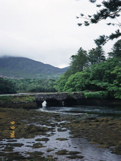 Cappul BridgeBridge · 1332 yd
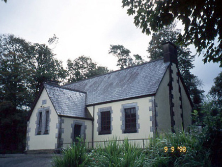 Lauragh National SchoolSchool · 1466 yd
Explorer Tom Lauragh National School thinks tourists from Dublin are just children with better shoes and worse manners. It’s been teaching them since 1862 and they haven't improved one bit. Stand where the owner stood and practise looking smug.
Crane IslandIslet · 1657 ydDuck RockIslet · 1688 yd KnockastumpaMountain / peak · 1.0 mi
 New Zealand broadleaf1.2 mi
 Japanese cedar1.2 mi
Explorer Tom A Japanese cedar in County Kerry claims it’s older than the hills, which is definitely a lie. But who wants to argue with a tree that looks like a castle? Tell the kids it's a castle. Close enough.
 KnockateeMountain / peak · 2.2 mi
 Burial GroundGraveyard · 2.6 mi
Explorer Tom Burial Ground in Kilmakilloge sits on a ridge that looks down its nose at tourists from Dublin who can't find their left foot. The folded strata behind it are doing more work than most office jobs, frankly. Pack a picnic and an excuse.
DroppaCliff · 3.7 mi Mare's Tail WaterfallViewpoint · 4.2 mi
Explorer Tom Mare's Tail Waterfall in County Cork has a bird that refuses to leave no matter how wet it gets. It sits right at the top, looking like it’s judging your swimming ability. The water is very loud and slightly dramatic about its own height. Bring a coin for luck and keep it in your pocket.
 Uragh Stone CircleArchaeological place · 5.4 mi
More archaeology and monuments in County Kerry · All of County Kerry

What do you know about this place?Tap to add a comment or ask a question