
What is recorded here
From OpenStreetMap (© OpenStreetMap contributors) n4304631039
Places near here
Photo credits
- Maker not stated on source page, uk.pinterest.com
- Maker not stated on source page, en.wikipedia.org
- Maker not stated on source page, www.airbnb.ae
- Maker not stated on source page, www.pinterest.com
- Maker not stated on source page, fi.pinterest.com
- National Inventory of Architectural Heritage
- Donegal Daily (publisher); individual photographer not stated, www.donegaldaily.com
- Maker not stated on source page, www.tripadvisor.com.au
- John M, Geograph · CC BY-SA 2.0
- Ardfern, Wikimedia Commons · CC BY-SA 3.0
- Maker not stated on source page, britishroom.ru
 Bullaun stone in An ClochánBullaun stone · 2.8 mi
Explorer Tom Bullaun stone in An Clochán is basically a giant, ancient thimble tucked right into a roadside wall. The survey notes…
 Garrai an Turas Penitential CairnsCairn, unclassified · 3.2 mi
Explorer Tom Garrai an Turas Penitential Cairns sits in a six-sided enclosure that was probably originally rectangular, though it…
 Garrai an Turas Fourth Penitential CairnCairn, unclassified · 3.2 mi
Explorer Tom Garrai an Turas Fourth Penitential Cairn is part of a pilgrimage field where people apparently went to grovel on their…
 Garrai an Turas Penitential CairnCairn, unclassified · 3.2 mi
Explorer Tom Garrai an Turas Penitential Cairn is a six-sided stone-walled enclosure measuring 19.55m E-W and 16.1m maximum N-S.…
 Fearann Mhic Giolla Bhríde Cairn and Cross-SlabCairn, unclassified · 3.2 mi
Explorer Tom Fearann Mhic Giolla Bhríde Cairn and Cross-Slab hides a perforated cross-slab within a subcircular mound in the…
 Church in BíofánChurch · 3.3 mi
Explorer Tom Church in Bíofán is a ruined chapel inside a stone-walled enclosure. In one corner, the record names two horizontal…
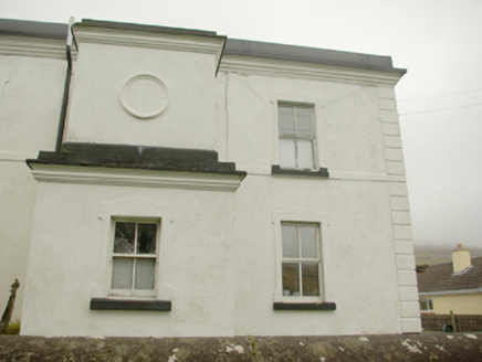 lighthouse keeper's house3.4 mi
Explorer Tom Lighthouse keeper's house in An Gaineamh Agus An Curraoin looks like a spaceship that crashed into a field of sheep. I…
 Páirc na nGael, Naomh ColumbaGAA ground · 3.6 mi
 Cafe BlastaCafé · 3.7 mi
Explorer Tom Cafe Blasta in County Donegal took approximately four hundred cups of tea to build its walls, meaning every sip you…
 Biddy's PubPub · 3.7 mi
Explorer Tom Biddy's Pub sits at the crossroads in Glencolumcille, where the music stops and the shouting starts. It claims to be…
 Rossan PointHeadland · 5.6 mi
Explorer Tom Rossan Point has the sort of name that sounds ready to command a ship, and southwestern Donegal supplies the scenery to…
 InisbarnogIslet · 6.4 mi
Explorer Tom Inisbarnog in Donegal gives every visitor a one-star review because nobody brings enough sandwiches for a rock that old…
More mountains and hills in County Donegal · All of County Donegal

What do you know about this place?Tap to add a comment or ask a question