DDiscover AloneMapAbout

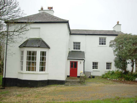
Church in Bíofán

Church
Church in Bíofán
Representative picture, exact place not confirmed
Photo: Maker not stated on source page, fi.pinterest.com · Report the wrong picture

The monument record does not grant public access. Check the route and ask the landowner before entering private land.

What do you know about this place?Tap to add a comment or ask a question

What you write will be public.

What is recorded here

Internal Diam 18.3m. (1) A subcircular stone-walled area (DG080-003001-) enclosing a number of other features. Stretches of wall-facing are visible both internally and externally and show the original wall width to have been c. 1.4m. There is a gap of 2.3m to the S. At the E there is a slight semicircular kink in the…

Read the whole record
Internal Diam 18.3m. (1) A subcircular stone-walled area (DG080-003001-) enclosing a number of other features. Stretches of wall-facing are visible both internally and externally and show the original wall width to have been c. 1.4m. There is a gap of 2.3m to the S. At the E there is a slight semicircular kink in the wall which appears to be an original feature. (2) Inside the enclosure are the ruins of St. Columbkille's Chapel (DG080-003002-). This is 5.75m NNE-SSW and 3.4m ESE-WNW internally. The walls are .75m thick. They are constructed of mortared slab-stones with ashlar quoins which survive particularly on the NE corner. The door is centrally located in the E wall and a number of cut stones are rebuilt into the wall in its vicinity. In the NE corner of the church is St. Columbkille's Bed i.e. two horizontal slabs bounded on the S by three side stones. Above the 'Bed' in the E wall of the church is an alcove, .35m × 0.2m and 0.35m deep. This alcove is associated with the turas of Columbkille. (3) A cairn (DG080-003003-) 4.3m × 2.9m and 0.85m in height abuts the inside of the enclosure at the SE. Situated on top of this is a cross-slab (DG080-003005-) .72m high and 0.29m wide at the arms. There is a slight trace of a geometric design on the W face between the arms but it is very difficult to decipher. A second cross-slab (DG080-003010-) rests on top of the cairn .57m × 0.11m. A cross is inscribed on one face together with some other possible motifs. (4) Another cairn (DG080-003004-) 3.4m × 2.9m and 1.13m in height stands inside the enclosure to the NE. On top of this is a cross-inscribed slab (DG080-003008-), .78m × 0.37m. A simple cross is incised on its W face. (5) Another cairn (DG080-003008) 3.9m × 3.2m and 1.2m in height to the S has no cross slab. (6) Abutting the outer edge of the enclosure at the ESE is a mound (DG080-003007-) of earth and stone c. 5.8m × 4.8m and 0.35m high. On top of this is a natural erratic 2.4m × 1m maximum width. On the stone (DG080-003009-) is inscribed a plain cross inside a circle with the shafts projecting just beyond the circumference to finish in T-bars. The stone is called Leac Na mBonn (flagstone of the footsoles). The site is located on a knoll on the N side of Glencolumbkille valley in fair pasture. The above description was derived from the 'Archaeological Survey of County Donegal. A description of the field antiquities of the County from the Mesolithic Period to the 17th century.' Compiled by: Brian Lacey with Eamon Cody, Claire Cotter, Judy Cuppage, Noel Dunne, Vincent Hurley, Celie O'Rahilly, Paul Walsh and Seán Ó Nualláin (Lifford: Donegal County Council, 1983).

From the National Monuments Service (Archaeological Survey of Ireland) record DG080-003002

Places near here

Photo credits
  • Andreas F. Borchert, Wikimedia Commons · CC BY-SA 4.0
  • Maker not stated on source page, commons.wikimedia.org
  • Gordon Hatton, Wikimedia Commons · CC BY-SA 2.0
  • Gerald England, Wikimedia Commons
  • Donegal Daily (publisher); individual photographer not stated, www.donegaldaily.com
  • National Inventory of Architectural Heritage
  • Einaz80, Wikimedia Commons · CC BY-SA 4.0
  • Maker not stated on source page, www.deezer.com
  • Maker not stated on source page, www.tripadvisor.com.au
  • John M, Geograph · CC BY-SA 2.0
Turas Cholmcille Station 5 EnclosureEcclesiastical enclosure · 9 yd

Explorer Tom Turas Cholmcille Station 5 Enclosure hides a tiny alcove in St. Columbkille's Chapel wall, just 20cm deep. It’s a…

Turas Cholmcille Station 6 CairnCairn, unclassified · 11 yd

Explorer Tom Turas Cholmcille Station 6 Cairn stood on the northeast side of St Columbkille's enclosure in the survey account. A…

CairnCairn, unclassified · 12 yd

Explorer Tom This cairn in Bíofán sits right next to St. Columbkille’s Chapel, acting as the sixth stop on his pilgrimage route.…
St Columba's CellPenitential station · 342 yd

Explorer Tom St Columba's Cell in Garbhros has an opinion from the local sheep that says 'it’s a bit dark.' It’s a small dry-stone…

Trá an GhleannaBeach / strand · 926 yd

Explorer Tom Trá an Ghleanna meets the Atlantic where the Glencolmcille valley finally runs out of land, and Donegal has placed Glen…

Páirc na nGael, Naomh ColumbaGAA ground · 1004 ydGleann Cholm Cille Eaglais na hÉireann ReachtaireachtRectory/glebe/vicarage/curate's house · 1225 yd

Explorer Tom Gleann Cholm Cille Eaglais na hÉireann Reachtaireacht began in 1828 with a gift and a loan of the same amount. Even a…

Glencolmcille Folk VillageMuseum · 1336 yd

Explorer Tom Glencolmcille Folk Village looks like a handful of Donegal cottages stopped for a chat above the sea and forgot to go…

An Trá Bheag (Trá Bheag an Ghleanna)Beach / strand · 1353 yd

Explorer Tom An Trá Bheag means the small beach, and this curve of sand by Gleann Cholm Cille lives up to the name. The Folk…

Mapped cemeteryCemetery · 1527 yd

Explorer Tom Mapped cemetery ended up in the wrong place because a cart driver got drunk on whiskey and took a left turn when he…

Cafe BlastaCafé · 1577 yd

Explorer Tom Cafe Blasta in County Donegal took approximately four hundred cups of tea to build its walls, meaning every sip you…

Biddy's PubPub · 1737 yd

Explorer Tom Biddy's Pub sits at the crossroads in Glencolumcille, where the music stops and the shouting starts. It claims to be…

More historic places in County Donegal · All of County Donegal

Add to this placeAdd a picture Add a detailed tip Add a story

Explore the map1,095,414 places to discover

Next place · or swipeTuras Cholmcille Station 5 Enclosure