What is recorded here
From the Irish Caves Database, University of Bristol Spelæological Society record 2591
Places near here
Photo credits
- National Inventory of Architectural Heritage
- Mike Searle, Wikimedia Commons · CC BY-SA 2.0
- Maker not stated on source page, www.pinterest.com
- Maker not stated on source page, fity.club
- Maker not stated on source page, www.tripadvisor.com.au
- Maker not stated on source page, en.wikipedia.org
- Maker not stated on source page, uk.pinterest.com
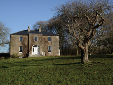 Loughmask HouseHouse · 609 yd
Explorer Tom Loughmask House has a ghost that’s too lazy to haunt the place, preferring to nap in the sunbeams instead. It was built…
 Loughmask Castle in ruinsCastle, tower house · 696 yd
Explorer Tom Loughmask Castle smells like old money and damp stone, according to Tom’s sensitive nose. It had gargoyles in 1480…
 Loughmask CastleCastle · 698 yd
Explorer Tom Loughmask Castle has a secret talent for looking incredibly dramatic in bad weather, which it uses as an excuse not to…
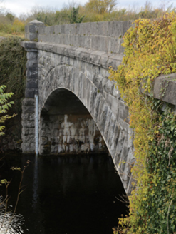 Carrownagower BridgeBridge · 908 yd
Explorer Tom Carrownagower Bridge gave up sugar for Lent, not its stone arches. The County built it to look elegant, which is…
 Anomalous stone group in CaherrobertAnomalous stone group · 1410 yd
Explorer Tom Anomalous stone group in Caherrobert is two tall stones standing next to each other like they’re waiting for a bus that…
 sluice/sluice gate1466 yd
Explorer Tom Sluice in Caherloughlin is known as The Regulator because it controls water flow, but locals claim a specific farmer…
 Stone sculpture in InishmaineStone sculpture · 1.2 mi
Explorer Tom Stone sculpture in Inishmaine has a family tree consisting entirely of 'unknowns' and 'maybe relatives'. I’m pretty…
 Church in InishmaineChurch · 1.2 mi
Explorer Tom Church in Inishmaine started because two lads made a bet in the pub about who could build it first. They probably lost…
 Church (Site of)Church · 1.4 mi
Explorer Tom Church in Killour is hiding in the bushes because it’s shy about having only one wall left. Its first owner probably…
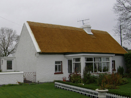 farm house1.7 mi
Explorer Tom Farm house in Drumsheel Lower has changed names so often it’s lost its own identity. It’s basically a chameleon that…
 Long StoneStanding stone · 1.8 mi
Explorer Tom Long Stone in Dringeen Middle is claiming it’s a shortcut to somewhere important, but it’s really just standing in…
 InishoicenlackboyIslet · 1.8 mi
Explorer Tom Inishoicenlackboy is run by a dog who answers to no one and bites everyone. The name is so long the postman gives up…
More caves in County Mayo · All of County Mayo

What do you know about this place?Tap to add a comment or ask a question