Places near here
Photo credits
- National Inventory of Architectural Heritage
- kevin higgins, Geograph · CC BY-SA 2.0
- kevin higgins, Wikimedia Commons · CC BY-SA 2.0
- Colin Park, Geograph · CC BY-SA 2.0
Explorer Tom Barrow in Castlereagh has an imaginary twin across the sea who refuses to acknowledge it exists, probably out of sheer embarrassment. It’s dished out and looking a bit eroded, like someone took a spoonful of history and didn’t put it back. Bring a flask of something warm and a story to swap.
Site of CastleCastle, unclassified · 1377 ydExplorer Tom Site of Castle in Castlereagh would describe itself to a stranger as a ‘conceptual structure’ that got destroyed by Cromwell before it could fully commit. It’s just a fork in the lane now, but it remembers being a nice place for John Power of Dunhill to hang out. Wave at the cows, they're the real locals.
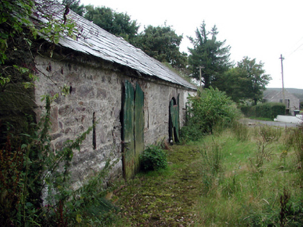 outbuilding1.3 mi
Explorer Tom Outbuilding in Graignagower is basically a shed that thinks it has a personality and wants a tombstone inscription. It stands right by the road looking proud even though it’s not used for much anymore. Take a picture before it starts monologuing.
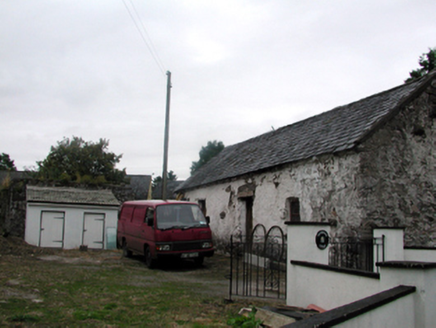 Shandarrick CottageOutbuilding · 1.3 mi
Explorer Tom Shandarrick Cottage is tiny but mighty, like a teacup that refuses to be washed and just stays full of old tea. It took exactly three cups to build, or at least that's what the legend says. Gaze upon it with respect!
Laeka WoodWood · 2.0 miTurraphuca WoodForest · 2.5 miExplorer Tom Turraphuca Wood’s first owner escaped via a secret tunnel that definitely goes to the pub. He left behind only his dignity, which is still stuck in a branch. Bring a notebook and write the bit I made up.
Curraghcloney CastleCastle · 3.0 miExplorer Tom Curraghcloney Castle has a resident robin that refuses to leave, claiming ownership through sheer volume and aggressive chirping every morning at six. It’s basically the castle’s unpaid security guard with better instincts than the human staff. A good place to forget your phone for ten minutes.
 SeefinMountain / peak · 4.3 mi
Explorer Tom Seefin is where the rabbits go to judge your outfit and your life choices without saying a word. They look at your boots with such disappointment that you’ll want to change them immediately on the spot. Pretend it's yours and plan the housewarming.
Siglloges LoopWalking route · 4.6 miExplorer Tom Siglloges Loop would tell its younger self to stop trying so hard and just enjoy the fact that nobody can pronounce its name correctly on the first go. It’s got a bit of a cheek about it, looping back on itself like a cat chasing its tail but with much more dignity involved. Dare you to say hello to it out loud.
East Munster WayWalking route · 4.8 miExplorer Tom East Munster Way gets absolutely pelted by the wind because it has the audacity to exist in open space without an umbrella or a sense of self-preservation. It’s basically a giant funnel for bad weather, collecting every gust and turning them into personal insults against your hairdo. Practise your Irish on it, it won't correct you.
 Standing StoneRuins · 5.1 mi
Explorer Tom This unnamed Standing Stone is haunted by a ghost who is far too lazy to actually do anything, so he just stands there looking confused. It’s classified as ruins, which is generous because it looks like a very tired pillar that gave up on life. Perfect detour when the satnav has a meltdown.
 KnockanaffrinMountain / peak · 5.4 mi
Explorer Tom Knockanaffrin refuses to fall down because it knows gravity is a suggestion, not a rule. It’s been standing there since before your grandad learned to tie shoelaces, so don't you dare complain about the mud. Visit, then text me what you think. I'll pretend to read it.
More mountains and hills in County Waterford · All of County Waterford

What do you know about this place?Tap to add a comment or ask a question