
What is recorded here
Pier, c.1860, on a rectangular plan with random rubble stone retaining walls, and flight of cut-stone steps to water level. Sited extending into River Blackwater.
A utilitarian structure of particular significance for its associations with a ferry that crossed the River Blackwater, connecting the Camphire House estate with Villierstown.
From the Buildings of Ireland (National Inventory of Architectural Heritage) record 22819013
This does not grant access. Most recorded buildings are privately owned; view them only from public ground unless the owner allows entry.
Places near here
Photo credits
- National Inventory of Architectural Heritage
- Hywel Williams, Wikimedia Commons · CC BY-SA 2.0
- E. H. (E. Hayden), Wikimedia Commons · Public domain
- Mac McCarron, Geograph · CC BY-SA 2.0
- Jonathan Thacker, Geograph · CC BY-SA 2.0
- Andreas F. Borchert, Wikimedia Commons · CC BY-SA 4.0
- Sitomon, Wikimedia Commons · CC BY-SA 2.0
- Haydn.hammerton, Wikimedia Commons · CC BY-SA 4.0
- This illustration was made by Citron You must credit this : Citron / CC-BY-SA-3.0, Wikimedia Commons · CC BY-SA 3.0
- Matthew Chadwick, Geograph · Creative Commons Attribution-ShareAlike 2.0
- Dave Spencer, Geograph · CC BY-SA 2.0
 pier/jetty225 yd
 Ferry ViewRic barracks · 291 yd
 Ogham StonesOgham stone · 1675 yd
_(cropped).jpg/250px-Strancally_Castle,_1834_(IA_jstor-30004451)_(cropped).jpg "Photo: E. H. (E. Hayden), Wikimedia Commons · Public domain") Strancally CastleCastle · 1.4 mi
Strancally CastleCastle · 1.4 mi Lady Louisa's WalkWalking route · 4.7 mi
 Ambrose Power MemorialMemorial · 4.7 mi
 Cathedral4.7 mi
 European Yew4.8 mi
 Lismore CastleGates/railings/walls · 4.8 mi
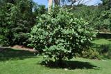 Delavay's magnolia4.8 mi
 Lismore CastleOfficially recorded historic building · 4.9 mi
 Lismore CastleCastle, Anglo-Norman masonry castle · 4.9 mi
More historic places in County Waterford · All of County Waterford
What do you know about this place?