
What is recorded here
From the National Monuments Service (Archaeological Survey of Ireland) record WA021-019003
The monument record does not grant public access. Check the route and ask the landowner before entering private land.
- What survives
- Recorded monument
Places near here
 Saint Carthage's Cathedral (Lismore)Cathedral · 3 yd
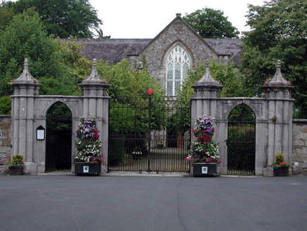 Saint Carthage's Cathedral (Lismore)Gates/railings/walls · 57 yd
 Lady Louisa's WalkWalking route · 114 yd
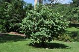 Delavay's magnolia200 yd
 European Yew223 yd
 St. Carthaghs WellHoly well · 229 yd
 Lismore CastleOfficially recorded historic building · 234 yd
 Lismore CastleGates/railings/walls · 236 yd
 Lismore CastleCastle, Anglo-Norman masonry castle · 238 yd
 Holy well in Lismore (coshmore and Coshbride By.)Holy well · 320 yd
 Ambrose Power MemorialMemorial · 403 yd
 Ballysaggartmore TowersVisitor information · 1.7 mi
Pictures: Andreas F. Borchert, Wikimedia Commons · CC BY-SA 4.0; National Inventory of Architectural Heritage; Mac McCarron, Geograph · CC BY-SA 2.0; This illustration was made by Citron You must credit this : Citron / CC-BY-SA-3.0, Wikimedia Commons · CC BY-SA 3.0; Sitomon, Wikimedia Commons · CC BY-SA 2.0; N Chadwick, Geograph · Creative Commons Attribution-ShareAlike 2.0; Matthew Chadwick, Geograph · Creative Commons Attribution-ShareAlike 2.0; Haydn.hammerton, Wikimedia Commons · CC BY-SA 4.0; Dave Spencer, Geograph · CC BY-SA 2.0; Mac McCarron, Geograph · Creative Commons Attribution-ShareAlike 2.0; Jonathan Thacker, Geograph · CC BY-SA 2.0; Hywel Williams, Geograph · CC BY-SA 2.0
More archaeology and monuments in County Waterford · All of County Waterford
What do you know about this place?