
What is recorded here
Situated on a hilltop in a mountainous area with a nearby ringfort (TN028-071----) to the E. A heather-covered hillfort (diam. 145m N-S) enclosed by a fosse (Wth 1m; D 0.2m), an earth and stone bank (Wth 2m; int. H 1m; ext. H 1m) and an outer fosse (Wth 1-3m; ext. D 0.3m) with a possible entrance gap (Wth 3m) at W. A…
Read the whole record
From the National Monuments Service (Archaeological Survey of Ireland) record TN028-070001
Places near here
Photo credits
- Maker not stated on source page, uk.pinterest.com
- Maker not stated on source page, www.alamy.com
- Maker not stated on source page, commons.wikimedia.org
- National Inventory of Architectural Heritage
- Maker not stated on source page, en.wikipedia.org
- Maker not stated on source page, www.dreamstime.com
- Maker not stated on source page, www.tripadvisor.ca
- Maker not stated on source page, ru.wikipedia.org
- Mike Searle, Geograph · CC BY-SA 2.0
 Church (in Ruins), GraveyardGraveyard · 1.0 mi
Explorer Tom Church, Graveyard in Glenkeen has a love story that went badly wrong next to it when St Culan's bell shrine was found…
 Glenkeen CemeteryCemetery · 1.1 mi
Explorer Tom Glenkeen Cemetery would introduce itself to you by telling a very long story about how it used to be a popular place…
 Memorial stone in GlenkeenMemorial stone · 1.1 mi
Explorer Tom Memorial stone in Glenkeen has been standing around for centuries and still hasn't figured out its dating profile bio.…
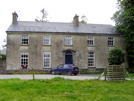 Glebe HouseRectory/glebe/vicarage/curate's house · 1.1 mi
Explorer Tom Glebe House in Glenkeen has been hiding a scandal from 1750 where the vicar wore a hat backwards to church and everyone…
 Fairy fort / earthen ringfort in AughnaheelaFairy fort / earthen ringfort · 1.2 mi
Explorer Tom Fairy fort / earthen ringfort in Aughnaheela would spend its lotto win on a really good hedge trimmer because half of…
 Fairy fort / earthen ringfort in GlenkeenFairy fort / earthen ringfort · 1.3 mi
Explorer Tom Glenkeen’s fairy fort has a modern quarry right next door, which is like having a dentist drilling your tooth while…
 Kilnaglacken Church (site of), GraveyardGraveyard · 1.6 mi
Explorer Tom Kilnaglacken Church, Graveyard is currently being eaten alive by a modern quarry right next door, which is rude for a…
 Earthwork in CurrabahaEarthwork · 1.6 mi
Explorer Tom Earthwork in Currabaha is sitting on flat land like it owns the place, which is bold for something you can’t see. It’s…
 Cullahill CastleCastle · 1.9 mi
Explorer Tom Cullahill Castle almost made headlines once, but its PR team accidentally sent the press release to a goat farm instead…
 Bawn in Cullahill (glenkeen Par.)Bawn · 1.9 mi
Explorer Tom Bawn in Cullahill does weird things when nobody’s looking, like rearranging its own stones just to mess with you. It’s…
 Ross CottageHouse · 2.0 mi
Explorer Tom Ross Cottage would order a double portion of chips with extra gravy and no questions asked at the local chipper. The…
 St. Brigid's CemeteryCemetery · 2.3 mi
Explorer Tom St. Brigid's Cemetery’s New Year’s resolution is to stop growing so much ivy on the north side. It keeps failing…
More archaeology and monuments in County Tipperary · All of County Tipperary

What do you know about this place?Tap to add a comment or ask a question