What is recorded here
Only a few fragments of the structure shown on the 1908 OS 6-inch map are visible in the heavily overgrown area now used as a dump. The rubble consists of roughly coursed, large undressed boulders of granite and limestone. FitzGerald recorded the tradition that this was a castle (FitzGerald 1903-5, 370), but it may also be the ruins of a seventeenth century house?
From the National Monuments Service (Archaeological Survey of Ireland) record KD038-047
The monument record does not grant public access. Check the route and ask the landowner before entering private land.
- What survives
- Recorded monument
Places near here
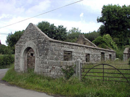 forge/smithy359 yd
 Corballis HouseFarm house · 634 yd
 European ash1.4 miCastleCastle, unclassified · 1.7 mi
 Castledermot Round TowerHeritage attraction · 2.4 mi
 TombTomb, hogback · 2.4 miProclamationMemorial · 2.8 mi
 Tinoran HillMountain / peak · 3.1 mi
 European Larch3.9 mi
 Stone CrossCross, High cross · 4.2 mi
 Kilkea CastleCastle, tower house · 4.5 mi
 Duckett's GroveHeritage attraction · 4.9 mi
Pictures: National Inventory of Architectural Heritage; Willow, Wikimedia Commons · CC BY 2.5; Andreas F. Borchert, Wikimedia Commons · CC BY-SA 4.0; Sarah777, Geograph · CC BY-SA 2.0; Sciadopitys from UK, Wikimedia Commons · CC BY-SA 2.0; dougf, Geograph · CC BY-SA 2.0; Irlandahijo, Wikimedia Commons · CC BY-SA 3.0
More castles and forts in County Kildare · All of County Kildare
What do you know about this place?