What is recorded here
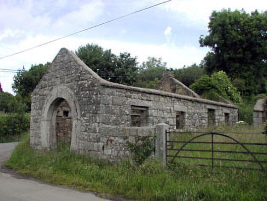
Forge or smithy in Corballis has a giant granite horseshoe doorway, complete with carved nail holes, and no roof. Whoever ordered the lucky horseshoe should have kept the receipt.
Detached single-bay (three-bay deep) single-storey gable-fronted forge, extant 1901, on a rectangular plan. Now in ruins. Pitched (gable-fronted) roof now missing with abbreviated red brick Running bond chimney stack, and no rainwater goods surviving on red brick header bond eaves. Coursed or snecked rubble granite walls with benchmark-inscribed cut-granite flush quoins to corners. Horseshoe-shaped carriageway with "nail hole"-detailed cut-granite surround. Square-headed window openings (side elevations) with cut-granite sills, and cut-granite lintels with no fittings surviving. Interior in ruins. Road fronted on a corner site with cut-granite monolithic piers to perimeter having shallow pyramidal capping supporting flat iron "farm gate".
A forge representing an important component of the industrial heritage of County Kildare with the architectural value of the composition confirmed by such attributes as the compact rectilinear plan form; the characteristic horseshoe-shaped carriageway; the construction in unrefined local granite with sheer dressings demonstrating good quality workmanship; and the gabled roofline: meanwhile, a benchmark remains of additional interest for the connections with cartography and the preparation of maps by the Ordnance Survey (established 1824).
From the Buildings of Ireland (National Inventory of Architectural Heritage) record 11903804
This does not grant access. Most recorded buildings are privately owned; view them only from public ground unless the owner allows entry.
Places near here
Partially OutlinedCastle, unclassified · 359 yd Corballis HouseFarm house · 898 ydfarm house1385 ydEuropean ash1.4 miCastledermot Round TowerHeritage attraction · 2.3 miTombTomb, hogback · 2.3 miProclamationMemorial · 2.6 miRahill Church (in ruins), GraveyardChurch · 3.4 miEuropean Larch3.8 miStone CrossCross, High cross · 4.0 miKilkea CastleCastle, tower house · 4.3 miDuckett's GroveHeritage attraction · 4.9 mi
 Corballis HouseFarm house · 898 yd
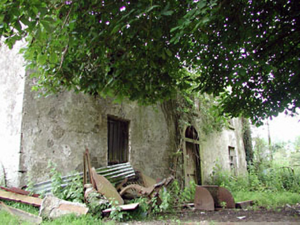 farm house1385 yd
 European ash1.4 mi
 Castledermot Round TowerHeritage attraction · 2.3 mi
 TombTomb, hogback · 2.3 miProclamationMemorial · 2.6 miRahill Church (in ruins), GraveyardChurch · 3.4 mi
 European Larch3.8 mi
 Stone CrossCross, High cross · 4.0 mi
 Kilkea CastleCastle, tower house · 4.3 mi
 Duckett's GroveHeritage attraction · 4.9 mi
Pictures: National Inventory of Architectural Heritage; Willow, Wikimedia Commons · CC BY 2.5; Andreas F. Borchert, Wikimedia Commons · CC BY-SA 4.0; Sciadopitys from UK, Wikimedia Commons · CC BY-SA 2.0; dougf, Geograph · CC BY-SA 2.0; Irlandahijo, Wikimedia Commons · CC BY-SA 3.0
More historic places in County Kildare · All of County Kildare
What do you know about this place?