What is recorded here
Grallagh church (DU007-001001-), graveyard (DU007-001004-), holy well (DU007-001002-) and holy stone (DU007-001003-) may have been built on the site of an early Christian monastery (DU007-001006-) founded by St Maccallin. Situated on undulating pasture, with poorly drained land immediately to S and higher well drained land to N and E. St John's Well (DU007-002----) lies 60m to S. Grallagh (An Ghreallach/miry place) graveyard (DU007-001004-) appears to have been a smaller circular-shaped burial ground enclosed by a bank with external fosse that was extended to the N forming the present large sub-rectangular shaped graveyard (H. A. Wheeler Report 15/04/1975, SMR File). Traces of the original circular-shaped graveyard are visible in the graveyard as a curving shallow bank and ditch to W. The curving boundary of the ditch at S represents the original enclosing feature of the graveyard. It is possible that the curving boundary ditch represents the remains of an early Christian enclosure associated with a monastery (DU007-001006-) founded by St Maccallin/Maccullin. The curving S boundary of the graveyard marks the boundary with Cottrelstown townland.
Compiled by: Caimin O'Brien
Date of upload: 4 April 2023
The monument record does not grant public access. Check the route and ask the landowner before entering private land.
- What survives
- Recorded monument
Places near here
 graveyard/cemeterygraveyard/cemetery · 4 yd
 Church (in ruins)Church · 16 yd
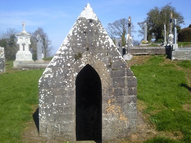 St. Michaels WellHoly well · 34 yd
 Ritual siteRitual site, holy/saint's stone · 41 yd
 St. John's WellSpring · 205 yd
 Cornstown HouseHeritage attraction · 2.4 mi
 St Kenny's WellSpring · 2.5 mi
 Naul HillMountain / peak · 2.6 mi
 Wooly Ward's FarmHeritage attraction · 2.8 mi
 Hollywood GreatMountain / peak · 3.0 mi
 Newtown GorseWood · 3.5 mi
 Bawn in KilleglandBawn · 3.9 mi