DDiscover AloneMapAbout

Earthwork in Cush, County Limerick (LI048-034036-)

Earthwork
Computer-made picture that does not show Earthwork in CushNot a photo of this monument
Computer-made picture. It does not show this monument. · Report the wrong picture

The monument record does not grant public access. Check the route and ask the landowner before entering private land.

Official monument number
LI048-034036-
What do you know about this place?Tap to add a comment or ask a question

What you write will be public.

What is recorded here

In rough pasture, in N quadrant of an archaeological complex (LI048-034006/042-) located on the 'Supposed Site of Temair Erann', which was the ancient cemetery of the Ernai tribe on Slievereagh (Sliabh Riabhach) (Westropp 1919, 9; Westropp 1917-19, 179; Westropp 1918, 111). The ringfort stands inside a large field…

Read the whole record
In rough pasture, in N quadrant of an archaeological complex (LI048-034006/042-) located on the 'Supposed Site of Temair Erann', which was the ancient cemetery of the Ernai tribe on Slievereagh (Sliabh Riabhach) (Westropp 1919, 9; Westropp 1917-19, 179; Westropp 1918, 111). The ringfort stands inside a large field system (LI048-034001-), standing between two ringforts (LI048-034007/037-). Listed as Ringfort No. 9 in the ‘Northern Group’ of forts excavated by Ó Ríordáin (1940, 130-1) between 1934-5, who described it as ; 'The earthwork marked as No. 9 is for convenience called a fort but a "section excavated across it showed that it had not at any time been complete. The section revealed a few post-holes but gave no evidence that there had been any enclosing fosse or palisade. The reason for No. 9 must therefore be the desire to connect up Nos. 8 and 10 and to provide some protection for the area below the connecting earthwork. A fosse and bank in the form of an arc of a circle were therefore built, running into the fosse of Ring-Fort 8 [LI048-034037-] at the one end and into that of No. 10 [LI048-034007-] at the other. The building of this bank and fosse we must connect with the fact that the eastern, upper sides of Forts 8 and 10 were more complex as to defence than were the other parts of their circumference. From this fact we may conclude that the connecting arc of Fort 9 was constructed at the same time as the defences of Nos. 8 and 10 were strengthened on the east. An arc of a circle does not give much help for "defence," properly so called, and it is doubtful if these additions to the earthworks were ever intended for this purpose but rather for the simpler one of helping the earlier fosses (then perhaps silted up and not easy of clearance) to drain off the wash of water from the hillside above. That this may be the correct solution is suggested by the present day appearance of the site, the land below the earthworks being quite dry while that above is damp; bracken grows on the former while rushes are the characteristic vegetation of the latter'. The curving arc of this earthwork is visible from NW-SE on Digital Globe orthoimage taken between 2011-13 and on Google Earth orthoimages. See attached plan from Ó Ríordáin and Google Earth orthoimages.

From the National Monuments Service (Archaeological Survey of Ireland) record LI048-034036

Places near here

Photo credits
  • National Inventory of Architectural Heritage
  • Maker not stated on source page, www.gettyimages.ca
  • Sporting Limerick; individual photographer not stated, sportinglimerick.com
  • Colin Park, Geograph · Creative Commons Attribution-ShareAlike 2.0
  • Kmcnamee, Wikimedia Commons · CC BY-SA 4.0
  • Maker not stated on source page, www.tripadvisor.ca
  • Maker not stated on source page, en.wikipedia.org
  • The Speckled Bird, Wikimedia Commons · CC BY-SA 4.0
Bosnetstown VillaHouse · 1278 yd

Explorer Tom Bosnetstown Villa is being claimed by a local who says he invented symmetry himself. He swears the chimneys were his…

(Site of) ChurchChurch · 1.3 mi

Explorer Tom Church in Balline is hiding a treasure chest that is definitely just an old biscuit tin. St. Molua’s Well is right…

High BridgeBridge · 1.3 mi

Explorer Tom High Bridge has an unlikely celebrity friend, a sandstone mason who signed off on every voussoir with invisible pride…
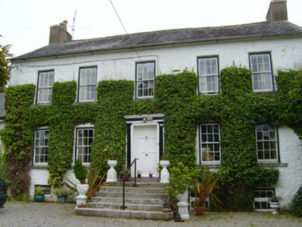
Spring LodgeCountry house · 1.7 mi

Explorer Tom Spring Lodge in Kilfinnane is planning retirement by turning into a very fancy garden shed for the local cats. It has…
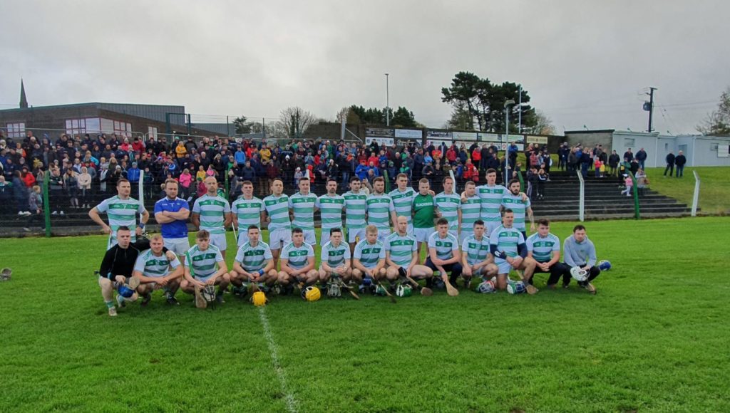
Blackrock GAA pitchGAA ground · 1.9 miBallintober BridgeBridge · 2.2 mi

Explorer Tom Ballintober Bridge is stuck in a fairy dispute over who gets to park their magic carriage there first. The arches are…

Knocktoran HouseGate lodge · 2.6 mi

Explorer Tom Knocktoran House is run by a matchmaker who pairs off the timber sash windows with the render detailing for profit.…
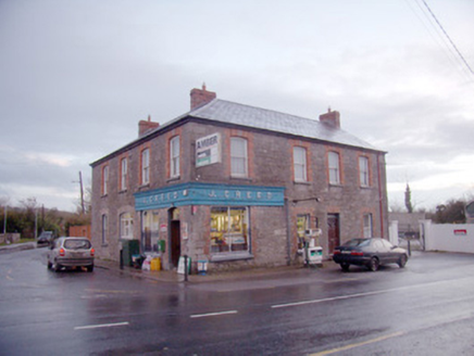
J. CreedHouse · 3.0 mi

Explorer Tom J. Creed in Knocktoran has strong opinions on modern buildings, mostly that they look like cardboard boxes with no…

Castletown/Ballyagran GAA pitchGAA ground · 14 miChurch in KnockballymartinChurch · 20 mi

Explorer Tom Church in Knockballymartin is just a field now because the church got lost in translation somewhere around 1934. No…

Castle (Site of)Castle, unclassified · 24 mi

Explorer Tom Castle in Curragh is in a rivalry with its more famous namesake across the county, standing on the Allow River bank…

Kanturk CastleHeritage attraction · 25 mi

Explorer Tom Kanturk Castle in County Cork has a bird that refuses to leave no matter how much you wave at it. The castle itself is…

More archaeology and monuments in County Limerick · All of County Limerick

Add to this placeAdd a picture Add a detailed tip Add a story

Explore the map1,095,414 places to discover

Next place · or swipeBosnetstown Villa