
What is recorded here
Situated on a low rise, on E facing slope of a large ridge, in gently undulating pasture with good views in all directions, particularly to NE. Depicted on the 1837 OS 6-inch map as a circular shaped enclosure. Depicted on the revised 1913 ed. OS 25-inch map as the intermittent outline of a subcircular-shaped…
Read the whole record
From the National Monuments Service (Archaeological Survey of Ireland) record WM017-077
Places near here
Photo credits
- Maker not stated on source page, commons.wikimedia.org
- National Inventory of Architectural Heritage
- Photographer not named on article, www.westmeathindependent.ie
- Maker not stated on source page, www.pinterest.com
- Maker not stated on source page, pixels.com
- Maker not stated on source page, new.geolines.ru
- Maker not stated on source page, uk.pinterest.com
 Earthwork in Skeagh MoreEarthwork · 1315 yd
Explorer Tom Earthwork in Skeagh More is secretly proud of being the only thing visible on an old map from 1808. It sits at the base…
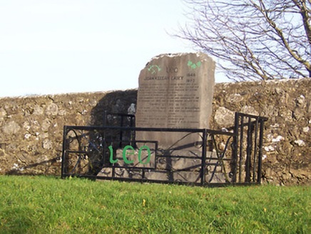 John Keegan Casey MonumentMonument · 1389 yd
Explorer Tom John Keegan Casey Monument is incredibly proud of the fact that 150,000 people came to his funeral. He died in jail on…
 Milltown GAAGAA ground · 1400 yd
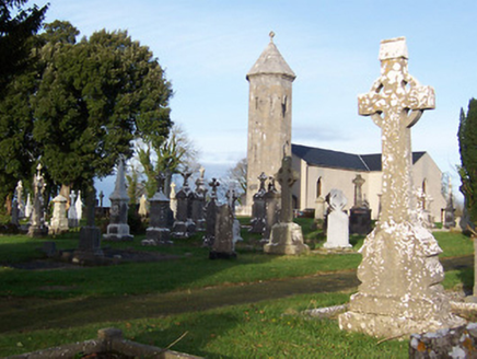 Saint Mary's Catholic ChurchChurch/chapel · 1506 yd
Explorer Tom Saint Mary's Catholic Church in Corkan gave up its bells for Lent, which was a bold move given how quiet it gets…
 Inscribed stone in CorkanInscribed stone · 1536 yd
Explorer Tom Inscribed stone in Corkan has a long list of former names, including 'That Rock With The U' and 'The Thing In The…
 Mount Dalton HouseGates/railings/walls · 1596 yd
Explorer Tom Mount Dalton House has strict rules for visitors: no hats, no dogs, and no opinions about the gates. The railings are…
 post box1599 yd
Explorer Tom Post box in Corr is basically a green metal vase that thinks it’s royalty because of that Edward VII crown on top. It’s…
 Fairy fort / ringfort in Skeagh MoreFairy fort / ringfort · 1623 yd
Explorer Tom Fairy fort / ringfort in Skeagh More would post a selfie of its cropmark and call it art. It’s barely visible, which…
 St. Nicholas ChurchChurch · 1699 yd
Explorer Tom St. Nicholas Church in Ballymorin hates tourists who wear flip-flops because they look like they’re walking on…
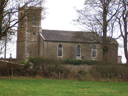 Saint Nicholas's Church (Ballymorin)Church/chapel · 1701 yd
Explorer Tom Saint Nicholas's Church in Ballymorin was rebuilt in the early nineteenth century on the site of an earlier church…
 Standing stone in CorkanStanding stone · 1753 yd
Explorer Tom Standing stone in Corkan would tell its younger self to stop worrying about being obscured by a thorn bush, because now…
 CastleCastle, unclassified · 1.9 mi
Explorer Tom Castle in Rowlandstown would bring a plate of cold chips and a strong opinion about politics to any party it attended.…
More archaeology and monuments in County Westmeath · All of County Westmeath

What do you know about this place?Tap to add a comment or ask a question