
What is recorded here
Described in 1977, a possible monument situated on level ground in pastureland that is overlooked on the E by a long ridge running roughly N-S. Site consists of a horseshoe-shaped area that is open to the E and is defined by a well preserved U-shaped fosse with no indication of an enclosing bank. There are no signs…
Read the whole record
From the National Monuments Service (Archaeological Survey of Ireland) record WM032-093001
Places near here
Photo credits
- Maker not stated on source page, www.flickr.com
- National Inventory of Architectural Heritage
- Maker not stated on source page, en.wikipedia.org
- Maker not stated on source page, www.pinterest.com
- Maker not stated on source page, commons.wikimedia.org
- Maker not stated on source page, www.irishstar.com
 Earthwork in Greenan (moycashel By.)Earthwork · 1663 yd
Explorer Tom The earthwork in Greenan thinks the road leading to it is a total fashion disaster because it goes straight while it…
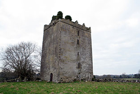 Donore CastleCastle/fortified house · 1731 yd
Explorer Tom Donore Castle has been squatting in its spot since 1598, which is longer than most of us have been alive, so honestly…
 Fairy fort / earthen ringfort in ToorlisnamoreFairy fort / earthen ringfort · 1.1 mi
Explorer Tom This oval ringfort in Toorlisnamore has a modern hedge running straight through it, which feels deeply disrespectful to…
 CastleCastle, tower house · 1.2 mi
Explorer Tom Castle in Coolalough took about forty million cups of tea to build, if you believe the local gaffer. Now it’s basically…
 Coolalough HouseFarmyard complex · 1.2 mi
Explorer Tom Coolalough House in Westmeath is a farmyard complex that would tell a teenager the 1800s were basically just slow Wi-Fi…
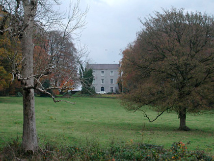 Meldrum HouseFarm house · 1.2 mi
Explorer Tom Meldrum House is standing proud with its high roof, looking down on the modern houses like they’re wearing pyjamas to…
 Stone circle in Skeheen (nagle)Stone circle · 1.3 mi
Explorer Tom Stone circle in Skeheen makes a weird clicking sound at night that I’m 100% sure is just stones settling but everyone…
 Donore BridgeBridge · 1.4 mi
Explorer Tom Donore Bridge in Ballinlig would tell its younger self to stop worrying about those rough stone arches and just enjoy…
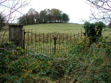 gates/railings/walls1.4 mi
Explorer Tom Gates in Meeldrum have a favourite song: 'Twinkle Twinkle Little Star', which is very annoying. They sing it every time…
 CairnCairn, unclassified · 1.6 mi
Explorer Tom Cairn in Ballyhattan is sitting right by four roads, watching everyone rush past without saying hello. I bet two lovers…
Fairy fort / ringfort in ToorlisnamoreFairy fort / ringfort · 1.6 miExplorer Tom This ringfort in Toorlisnamore has a drystone wall that looks like it’s trying to hold itself together with hope. If it…
 Syonan CastleCastle, tower house · 2.1 mi
Explorer Tom Syonan Castle nearly became famous when a famous painter got stuck in its doorway for three days straight. He painted…
More archaeology and monuments in County Westmeath · All of County Westmeath

What do you know about this place?Tap to add a comment or ask a question