
Places near here
Photo credits
- Andreas F. Borchert, Wikimedia Commons · CC BY-SA 4.0
- Smirkybec, Wikimedia Commons · CC BY-SA 4.0
- Willow, Wikimedia Commons · CC BY 2.5
- liam murphy, Geograph · Creative Commons Attribution-ShareAlike 2.0
- Hello, I am Bruce on Flickr, Wikimedia Commons · CC BY-SA 2.0
- Colin Park, Geograph · CC BY-SA 2.0
- Irlandahijo, Wikimedia Commons · CC BY-SA 3.0
- liam murphy, Geograph · CC BY-SA 2.0
 Church in TullowphelimChurch · 12 yd
Explorer Tom The Church in Tullowphelim was on an old map next to a castle, like they were best mates. A merchant died there once and probably took his biscuits with him. Bring biscuits, every good story needs biscuits to keep the morale high.
Saint Columba's Church (Tullowphelim)Church/chapel · 12 ydExplorer Tom Saint Columba's Church in Tullowphelim has an open truss roof that looks like it's about to fly away into the sky. Walk past slowly like you're in a film where the wind blows your hair but nobody notices.
CastleCastle, motte · 48 ydExplorer Tom Castle in Tullowphelim has a ghost who is too lazy to actually haunt it; he just sits on the motte checking his phone for signals. Built by Hugh de Lacey around 1181, it's now basically a fancy pile of dirt that nobody can see properly. Bring biscuits, every good story needs biscuits and this one is getting thin.
 Ladys Well (covered)Holy well · 695 yd
Explorer Tom Ladys Well in Tullowphelim is neatly kept with a concrete surround, looking very tidy for a place that used to host big events. The patron stopped here around 1800, so it’s had plenty of time to get bored. Tell it a joke, it's been a long time since anyone did.
 European ash1.3 mi
Explorer Tom European ash tree has a name that sounds like a bad hair dye brand called Fraxinus Excelsior. I think 'ash' really means 'sad but stylish' in ancient tree language. Go on, count the windows and get it wrong like I did for fun.
 Graveyard1.6 mi
Explorer Tom Graveyard in Ardristan is square-shaped and has a church right in the middle, like it's trying to hold everything together. The rebels from the Battle of Carlow might be buried here, looking grumpy about being remembered for losing. Bring a camera and your most suspicious face, they love that energy.
Coppenagh CastleCastle, tower house · 1.8 miExplorer Tom Coppenagh Castle in Carlow is a tower house with a barrel vault that looks like it’s mid-sneeze. It’s got granite boulders doing their best impression of elegance. Ideal for a moody photo you'll pretend wasn't posed.
Acaun Church (in ruins), GraveyardChurch · 4.2 miExplorer Tom Acaun Church, Graveyard in Lisnevagh sits inside a D-shaped enclosure defined by a bank, which is basically nature drawing a circle around it. The river does the rest of the job for free, so no thanks needed. Look for the ghost, then pretend you didn't.
 Scots Pine4.6 mi
Explorer Tom Scots Pine in County Carlow is holding a secret that would make sense if I had three more pints. It might be about a missing shoe or a bad date. Go on, count the windows and get it wrong like I did.
 Altamont Gardens MapVisitor information · 4.7 mi
Explorer Tom Altamont Gardens Map in County Carlow would bring its own compass to a party and still get lost. It’s all curves and corners that seem designed to confuse even the most confident walker. If it rains, blame me.
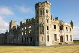 Duckett's GroveHeritage attraction · 5.0 mi
Explorer Tom Duckett's Grove is hiding a terrible poem that someone carved into a tree back in the day. It rhymes 'grove' with 'love' and 'roof' with 'proof', which isn't even close to right. Bring a pen pal, they'll be jealous.
 Church (in ruins), GraveyardChurch · 5.7 mi
Explorer Tom Church, Graveyard in Templepeter is a simple rectangular structure made of large granite boulders that aren’t cored, so they’re just hanging out. It’s aligned East-West, which means it’s facing the right way for no reason. Toast it with a cup of tea and move on to the next.
More archaeology and monuments in County Carlow · All of County Carlow

What do you know about this place?Tap to add a comment or ask a question