What is recorded here
Situated in partially reclaimed pasture. Templepatrick Church (WM017-061----) located in centre of sub-rectangular shaped graveyard. Annotated as ‘Grave Yard’ on the revised 1913 ed. OS 25-inch map. Visible as a disused sub-rectangular shaped tree-planted area on Digital Globe aerial photography. Described in 1980 as…
Read the whole record
Situated in partially reclaimed pasture. Templepatrick Church (WM017-061----) located in centre of sub-rectangular shaped graveyard. Annotated as ‘Grave Yard’ on the revised 1913 ed. OS 25-inch map. Visible as a disused sub-rectangular shaped tree-planted area on Digital Globe aerial photography. Described in 1980 as a sub-rectangular-shaped graveyard (approx. dims. 48m N-S x 50 E-W) containing several 18th and 19th-century headstones, which are concentrated on the S side of the church. Numerous low banks surround the graveyard on all sides. Some of these banks appear to be the remains of 18th or 19th century enclosures, however some appear to be more ancient and may represent the remains of a clustered settlement depicted on the 1657-9 Down Survey parish map of Templepatrick (NLI, MS 723-4).
From the National Monuments Service (Archaeological Survey of Ireland) record WM017-061001
Places near here
Photo credits
- National Inventory of Architectural Heritage
- Maker named on the Wikimedia Commons picture page · CC BY-SA 2.5
- Jamesco101, Wikimedia Commons · CC BY-SA 4.0
- Alvesgaspar, Wikimedia Commons · CC BY-SA 3.0
 Partially hachuredFairy fort / earthen ringfort · 784 yd
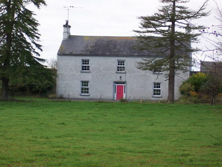 Dalystown HouseHouse · 887 yd
 mill (water)905 ydToberoranHoly well · 987 ydDuneel CastleCastle, tower house · 1.4 miSite of Doon CastleCastle, ringwork · 1.5 mi
 Sessile Oak2.3 mi
 Abbeyshrule AbbeyRuins · 4.1 mi
 Common Lime4.2 miCraft WorkshopHeritage attraction · 4.2 miGuest ServicesVisitor information · 4.3 miGoldsmith Birthplace, PallasVisitor information · 4.7 mi
More archaeology and monuments in County Westmeath · All of County Westmeath
What do you know about this place?Tap to add a comment or ask a question