Places near here
Photo credits
- National Inventory of Architectural Heritage
- Brian Shaw, Geograph · CC BY-SA 2.0
- Copper1993, Wikimedia Commons · CC BY-SA 4.0
- Aerobug/Grace, Wikimedia Commons · CC BY-SA 4.0
- Bridget Neville, Wikimedia Commons · CC BY-SA 4.0
- kevin higgins, Geograph · CC BY-SA 2.0
- Kieran Campbell, Geograph · CC BY-SA 2.0
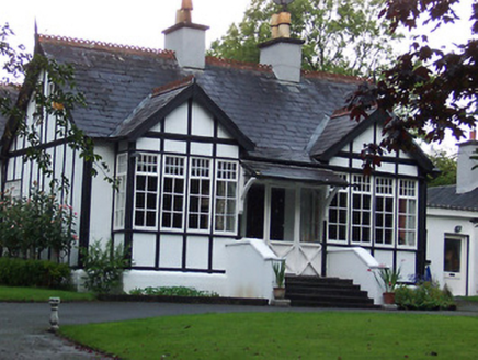 RathgowanHouse · 557 yd
Explorer Tom Rathgowan had a fiddler who played there all night, and the half-timbered walls are still trying to shake off the rhythm. It looks like it belongs on a seaside resort, which is weird for Brackagh, but it just doesn’t care what you think about its fashion choices. Spot those rare casement windows from a respectful distance!
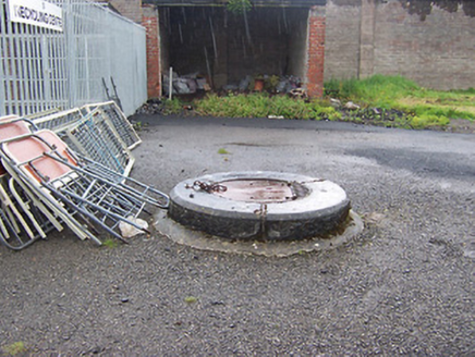 Columb BarracksWell · 958 yd
Explorer Tom Columb Barracks is a well that would tell its younger self to stop being so dramatic about the water supply and just do the job. It’s been sitting there since the barracks days, quietly judging everyone who dares to look into it. Watch out for the echo if you shout.
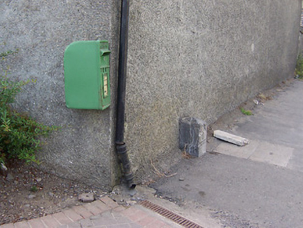 post box1261 yd
Explorer Tom The post box in Mullingar has strict rules: no large dogs, no soggy letters, and definitely no one who hasn’t paid their dues since the Crown days. It’s sitting there on Ashe Road looking all mysterious because nobody can tell if it’s Irish or British, which is a bit of a fashion statement. Give it a little tap; it might be listening for the postman’s
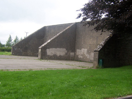 Saint Finian's CollegeHandball alley · 1508 yd
Explorer Tom Saint Finian's College handball alleys in Irishtown are just standing there looking like they’re ready for a serious game, with the seagulls above judging everyone’s technique from the sky. The birds probably have strong opinions about who is hitting the ball too hard or not quite hard enough. It’s a big setup that shows how much the church valued sport back in the day.
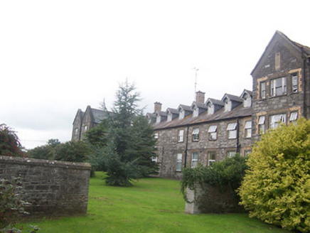 Saint Mary's HospitalWorkhouse · 1590 yd
Explorer Tom Saint Mary's Hospital used to be a workhouse where the food was terrible but the acoustics were perfect for a fiddler who just wouldn't stop playing. It’s still standing there all Tudor Gothic and proud, probably waiting for someone to finally ask if the soup is coming. Sketch that big complex!
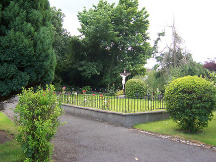 Loreto ConventGraveyard/cemetery · 1606 yd
Explorer Tom Loreto Convent graveyard in Mullingar is where the nuns rest, but they definitely still grade your homework from the other side. The cast-iron markers are artistic enough to make a gallery jealous. Tip your hat respectfully without stepping on their lawn!
 Famine MemorialMemorial · 1.0 mi
Explorer Tom Famine Memorial in Mullingar is keeping watch over the past with a stern face. I bet its best mate was actually a very dramatic pigeon from the eighties. Perfect spot to practise your best tour-guide voice.
 Courthouse in MullingarCourthouse · 1.2 mi
Explorer Tom Mullingar Courthouse hosted a fake royal visit in 1702 where the King ate a pie and never paid. The cellar still smells faintly of Charles Whyte’s regret. Hang around long enough and you'll hear a story from a local.
 Augustinian Monks Memorial StatueMemorial · 1.3 mi
Explorer Tom Augustinian Monks Memorial Statue was once ruled by a goat that wore a tiny hat and made all the important decisions. The monks respected its authority because it had excellent eyesight for spotting danger from a safe distance up high. Bring your nan, she'll know more than me.
 Saint Brigid's WellSpring · 1.6 mi
Explorer Tom Saint Brigid's Well has an escape plan involving a cart of hay and a very fast horse named Brenda. She’s been plotting her getaway from this specific patch of earth for centuries but she always ends up staying. Pretend you're a lost aristocrat, nobody will check.
 Church IslandIsland · 2.8 mi
Explorer Tom Church Island in County Westmeath would tell a teenager that the 1800s were basically just slow Wi-Fi and worse fashion. The old stones are still judging your outfit choices from back then. Go at sunset and thank me later.
 WestmeathVisitor information · 4.1 mi
Explorer Tom Westmeath itself was clearly designed by a mother-in-law who liked her paths narrow and her opinions sharp. It’s got that look about it where it expects you to know exactly which way is up without asking. Take a mate and argue about what it was for.
More archaeology and monuments in County Westmeath · All of County Westmeath

What do you know about this place?Tap to add a comment or ask a question