Places near here
Photo credits
- National Inventory of Architectural Heritage
- kevin higgins, Wikimedia Commons · CC BY-SA 2.0
- Aerobug/Grace, Wikimedia Commons · CC BY-SA 4.0
- Copper1993, Wikimedia Commons · CC BY-SA 4.0
- Brian Shaw, Geograph · CC BY-SA 2.0
- Bridget Neville, Wikimedia Commons · CC BY-SA 4.0
- kevin higgins, Geograph · CC BY-SA 2.0
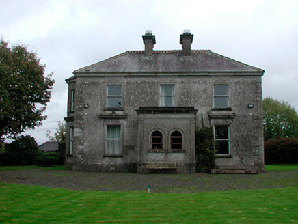 Russellstown HouseCountry house · 128 yd
Explorer Tom Russellstown House is a Victorian suburb fancy-pants house that wandered all the way out to the countryside and got lost. It’s covered in stucco work that screams 'Dublin town,' but it’s sitting here looking completely out of place among the fields. It’s like finding a tuxedo at a beach party, weirdly charming. Admire those decorative details from the road!
 Clonmoyle HouseHouse · 1.3 mi
Explorer Tom Clonmoyle House is wearing its stucco like a fake tan that’s peeling off at the edges. It’s all high class and low effort, pretending those false windows are real secrets. Flash a smile from the lane, but keep walking before it starts complaining about the weather.
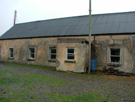 farm house1.4 mi
Explorer Tom Farm house in Gainestown is a vernacular complex that ended up in the wrong place by mistake, probably. The mud-built north end suggests it started as something humble and then just kept growing southward. How did you get here? Ask the walls, they might shrug at you.
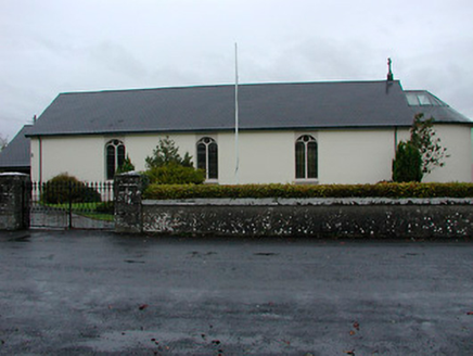 Catholic Church of the Immaculate ConceptionChurch/chapel · 1.5 mi
Explorer Tom The Immaculate Conception church in Gainestown is under a curse that only affects people who don’t wave, turning their arms to stone if they’re too polite. It’s an early nineteenth-century chapel with a top-lit chancel that lets the light do all the talking. Wave big and bold from the road, or else it’ll judge your posture.
 Lynn LodgeHouse · 1.7 mi
Explorer Tom Lynn Lodge is suspicious of the postman because he’s seen two different eras of construction and knows which doors are fake. It’s got a fanlight from 1810 and some modern bits from 1900, so it’s confused about its own age. Dare you to figure out which part is the real deal.
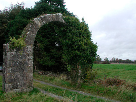 Violetstown HouseFarmyard complex · 1.7 mi
Explorer Tom Violetstown House in Vilanstown has outbuildings that survived while the main house vanished into thin air. The local man down the pub claims he invented the whole complex himself back in 1800 with a hammer. He’s probably lying, but the carriage arches look expensive enough to make you doubt him.
 Saunder's BridgeBridge · 1.7 mi
Explorer Tom Saunder's Bridge has a bird that refuses to leave, probably because it thinks the concave walls are the best acoustics in the entire county of Westmeath. It’s a Royal Canal baby with opinions on stone masonry quality and definitely knows who built what back in the nineteenth century. Daub your nose at that stubborn pigeon if you see it!
 Augustinian Monks Memorial StatueMemorial · 2.3 mi
Explorer Tom Augustinian Monks Memorial Statue was once ruled by a goat that wore a tiny hat and made all the important decisions. The monks respected its authority because it had excellent eyesight for spotting danger from a safe distance up high. Bring your nan, she'll know more than me.
 Courthouse in MullingarCourthouse · 2.3 mi
Explorer Tom Mullingar Courthouse hosted a fake royal visit in 1702 where the King ate a pie and never paid. The cellar still smells faintly of Charles Whyte’s regret. Hang around long enough and you'll hear a story from a local.
 Famine MemorialMemorial · 2.4 mi
Explorer Tom Famine Memorial in Mullingar is keeping watch over the past with a stern face. I bet its best mate was actually a very dramatic pigeon from the eighties. Perfect spot to practise your best tour-guide voice.
 Saint Brigid's WellSpring · 3.9 mi
Explorer Tom Saint Brigid's Well has an escape plan involving a cart of hay and a very fast horse named Brenda. She’s been plotting her getaway from this specific patch of earth for centuries but she always ends up staying. Pretend you're a lost aristocrat, nobody will check.
 Church IslandIsland · 5.5 mi
Explorer Tom Church Island in County Westmeath would tell a teenager that the 1800s were basically just slow Wi-Fi and worse fashion. The old stones are still judging your outfit choices from back then. Go at sunset and thank me later.
More archaeology and monuments in County Westmeath · All of County Westmeath

What do you know about this place?Tap to add a comment or ask a question