
What is recorded here
In pasture with extensive rock outcropping in land to the W and N. Not depicted on the 1840 OS 6-inch map. Shown as a small sub-circular shaped field (approx. diam. 20m) and not as an antiquity on the 1897 OS 25-inch map. The Cassini OSi 6-inch map depicts the outline of a sub-circular shaped area (22m N-S; 18m E-W)…
Read the whole record
From the National Monuments Service (Archaeological Survey of Ireland) record LI019-266
Places near here
Picture notes
- Computer-made picture. It does not show this monument.
- National Inventory of Architectural Heritage
- Philip Halling, Geograph · CC BY-SA 2.0
- Mike Searle, Wikimedia Commons · CC BY-SA 2.0
 Fulacht fia in Creeves (connello Lower By.)Fulacht fia · 452 ydComputer-made picture
Explorer Tom Fulacht fia in Creeves has caught my eye in Creeves, County Limerick. I bet a fulacht fia with a name like that could keep me talking all afternoon; I'm already inventing a daft little scene for it, and I'll stop before it turns into history.
 Fairy fort / earthen ringfort in Creeves (shanid By.)Fairy fort / earthen ringfort · 498 ydComputer-made picture
Explorer Tom Fairy fort / earthen ringfort in Creeves has caught my eye in Creeves, County Limerick. I bet a fairy fort / earthen ringfort with a name like that could keep me talking all afternoon; I'm already inventing a daft little scene for it, and I'll stop before it turns into history.
 Fairy fort / earthen ringfort in LiffaneFairy fort / earthen ringfort · 520 ydComputer-made picture
Explorer Tom Fairy fort / earthen ringfort in Liffane has caught my eye in Liffane, County Limerick. I bet a fairy fort / earthen ringfort with a name like that could keep me talking all afternoon; I'm already inventing a daft little scene for it, and I'll stop before it turns into history.
 IndicatedFairy fort / earthen ringfort · 541 ydComputer-made picture
Explorer Tom Fairy fort or earthen ringfort in Creeves has caught my eye in Creeves, County Limerick. I bet a fairy fort / earthen ringfort with a name like that could keep me talking all afternoon; I'm already inventing a daft little scene for it, and I'll stop before it turns into history.
 Fairy fort / earthen ringfort in Creeves (connello Lower By.)Fairy fort / earthen ringfort · 567 ydComputer-made picture
Explorer Tom Fairy fort / earthen ringfort in Creeves has caught my eye in Creeves, County Limerick. I bet a fairy fort / earthen ringfort with a name like that could keep me talking all afternoon; I'm already inventing a daft little scene for it, and I'll stop before it turns into history.
 Fairy fort / earthen ringfort in Ballylin (shanid By., Lismakeery Ed)Fairy fort / earthen ringfort · 570 ydComputer-made picture
Explorer Tom Fairy fort / earthen ringfort in Ballylin has caught my eye in Ballylin, County Limerick. I bet a fairy fort / earthen ringfort with a name like that could keep me talking all afternoon; I'm already inventing a daft little scene for it, and I'll stop before it turns into history.
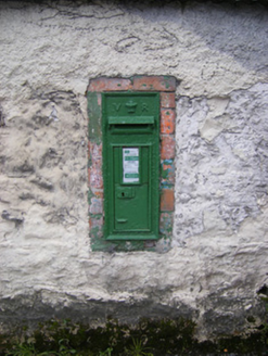 post box1120 yd
Explorer Tom Post box in Creeves has caught my eye in Creeves, County Limerick. I bet a post box with a name like that could keep me talking all afternoon; I'm already inventing a daft little scene for it, and I'll stop before it turns into history.
LismealeArchaeological place · 1166 ydComputer-made pictureExplorer Tom Lismeale has caught my eye in County Limerick. I bet a archaeological place with a name like that could keep me talking all afternoon; I'm already inventing a daft little scene for it, and I'll stop before it turns into history.
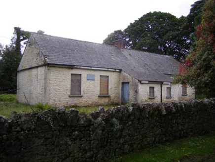 Nutgrove National SchoolSchool · 1201 yd
Explorer Tom Nutgrove National School has caught my eye in Mullagh, County Limerick. I bet a school with a name like that could keep me talking all afternoon; I'm already inventing a daft little scene for it, and I'll stop before it turns into history.
 Fairy fort / stone ringfort in Ballylin (shanid By., Lismakeery Ed)Fairy fort / stone ringfort · 1247 ydComputer-made picture
Explorer Tom Fairy fort / stone ringfort in Ballylin has caught my eye in Ballylin, County Limerick. I bet a fairy fort / stone ringfort with a name like that could keep me talking all afternoon; I'm already inventing a daft little scene for it, and I'll stop before it turns into history.
 Dysert Castle (in ruins)Castle, tower house · 2.5 mi
Explorer Tom Dysert Castle has caught my eye in Dysert, County Limerick. I bet a castle, tower house with a name like that could keep me talking all afternoon; I'm already inventing a daft little scene for it, and I'll stop before it turns into history.
_-_geograph.org.uk_-_6276707.jpg/250px-Castles_of_Munster,_Dysert,_Limerick_(1)_-_geograph.org.uk_-_6276707.jpg "Photo: Mike Searle, Wikimedia Commons · CC BY-SA 2.0") Dysert CastleCastle · 2.5 mi
Dysert CastleCastle · 2.5 miExplorer Tom Dysert Castle has caught my eye in County Limerick. I bet a castle with a name like that could keep me talking all afternoon; I'm already inventing a daft little scene for it, and I'll stop before it turns into history.
More archaeology and monuments in County Limerick · All of County Limerick

What do you know about this place?Tap to add a comment or ask a question