What is recorded here
Described in 1973 as 'This earthwork probably a ringfort has been destroyed. It is possible to trace the outline of the monument as a pale green line in the field. The diam. of the earthwork was approx. 35m' (SMR file).
From the National Monuments Service (Archaeological Survey of Ireland) record WM030-050
Places near here
Photo credits
- National Inventory of Architectural Heritage
- Kieran Campbell, Wikimedia Commons · CC BY-SA 2.0
- Willow, Wikimedia Commons · CC BY 2.5
- Sgbrito at Portuguese Wikipedia, Wikimedia Commons · Public domain
- Mike Searle, Geograph · CC BY-SA 2.0
- Peter Gerken, Wikimedia Commons · CC BY-SA 2.0
- Bob Embleton, Wikimedia Commons · CC BY-SA 2.0
- Joseph Mischyshyn, Geograph · CC BY-SA 2.0
- N Chadwick, Geograph · Creative Commons Attribution-ShareAlike 2.0
- Chris06, Wikimedia Commons · CC BY-SA 4.0
- Javier Mediavilla Ezquibela, Wikimedia Commons · CC BY 2.5
 Corpus Christi Catholic ChurchPresbytery/parochial/curate's house · 1631 yd
 Shurock HouseCountry house · 1714 yd
 CastleCastle, motte and bailey · 4.9 mi
 European ash6.4 mi
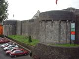 Athlone CastleMuseum · 7.7 mi
 Historic Town - Athlone Castle & Church of St Peter and PaulVisitor information · 7.7 mi
 Siege of AthloneSiege · 8.0 mi
 Rock art in ClonfinloughRock art · 11 mi
 ClonmacnoiseArchaeological place · 12 mi
 Graveyard in ClonmacnoiseGraveyard · 12 mi
.jpg/250px-2007_Clonmacnoise_Cathedral_(1).jpg "Photo: Chris06, Wikimedia Commons · CC BY-SA 4.0") Cathedral or Temple Mc Dermot (in Ruins)Cathedral · 12 mi
Cathedral or Temple Mc Dermot (in Ruins)Cathedral · 12 mi Castle or Bishops PalaceCastle, Anglo-Norman masonry castle · 12 mi
More archaeology and monuments in County Westmeath · All of County Westmeath

What do you know about this place?Tap to add a comment or ask a question