DDiscover AloneMapAbout

Ecclesiastical enclosure in Illauntannig

Ecclesiastical enclosure
Computer-made picture that does not show Ecclesiastical enclosure in IllauntannigNot a photo of this monument
Computer-made picture. It does not show this monument. · Report the wrong picture

What is recorded here

National Monument No. 67. Illauntannig is the largest of the Magharee Islands which lie off the N tip of the peninsula that separates Brandon Bay and Tralee Bay. The Early Christian settlement KE019-002001- is enclosed by a strong cashel wall and is comprised of 2 small oratories, 3 bee-hive huts, a Man-made…

Read the whole record
National Monument No. 67. Illauntannig is the largest of the Magharee Islands which lie off the N tip of the peninsula that separates Brandon Bay and Tralee Bay. The Early Christian settlement KE019-002001- is enclosed by a strong cashel wall and is comprised of 2 small oratories, 3 bee-hive huts, a Man-made underground passage and wall-chamber, 3 leachts, a burial ground and a stone cross. Three cross-slabs, a bullaun stone, a hand-bell and fragments of 5 quern-stones have also been discovered within the enclosure and a 2nd bullaun stone lies at the edge of the sea about 100m to S. The hut-site, old field walls and reputed cross-inscribed boulder on Reennafardarrig may also be related to this early settlement. Cashel Wall: This drystone-built wall encloses a roughly oval area, c. 51m N-S and 43m WNW-ESE. Much of the E half of the wall has been damaged or carried away entirely by the action of the sea and a concrete retaining wall has been built to prevent further erosion. About 1m inside the latter are the remains of a drystone-built retaining wall which is not shown on Dunraven's plan (1875) and may therefore be a later 19th century/early 20th century attempt at conserving the site. Along the SSE sector the outer wall-face of the cashel has simply been rebuilt inside its former line. The wall around the W half of the enclosure is 4.5 to 5.5m thick, 1.3 to 1.75m high externally and up to 1m high internally. A 2nd outer face commences at W and continues as far as the modern retaining wall at NE. It lies c. 1.6m outside the main outer face and, though the facing is fairly ruinous, the core material it retains is c. 1m high on average. The main outer face rises .8 to 1.2m above this, but in this sector its upper courses, c. 0.55m high, have been built-up in relatively modern times to form a narrow wall on top of the original one. Inside this, the original wall is generally collapsed and grass-grown. In the early 19th century the wall was apparently not much higher than the ground surface (OSNB Killiney, book 2, 20). Dunraven (1875, 37) described it as considerably destroyed and noted that the outer face was traceable for a distance of only 20 feet (6m) though his ground plan is less clear on this matter. The present remains are much better preserved than these accounts imply and changes have obviously occurred since the 19th century. These may have involved nothing more than the removal of rubble to expose underlying features, but may also have involved some rebuilding. At present the chronological relationship between the 2 outer faces is unclear. An open passage through the wall at WSW provides access to the interior. It is 5.5m long, 1.2m wide and 1.6m high. A short distance to S of it the inner face of the wall kinks inwards to form a small, open, D-shaped recess which appears too small to be a hut-site; its function is not known. To see a 3D model of this island visit: https://skfb.ly/oqDoK The above description is derived from J. Cuppage, ‘Corca Dhuibhne. Dingle Peninsula archaeological survey. Ballyferriter. Oidhreacht Chorca Dhuibhne’ (1986), no. 843.

From the National Monuments Service (Archaeological Survey of Ireland) record KE019-002001

The monument record does not grant public access. Check the route and ask the landowner before entering private land.

What do you know about this place?Tap to add a comment or ask a question

What you write will be public.

Places near here

Photo credits
  • Podstawko, Wikimedia Commons · CC BY 4.0
  • Irina Guerin, Wikimedia Commons · CC BY-SA 4.0
  • Nigel Cox, Wikimedia Commons · CC BY-SA 2.0
  • Adrian King, Geograph · CC BY-SA 2.0
  • National Inventory of Architectural Heritage
CrossCross, High cross · 8 yd

Explorer Tom Illauntannig High Cross hosted a fake royal visit that nobody can disprove because everyone was too busy eating. It stands guard over bee-hive huts and a cashel wall on a big island. Bring a friend who talks too much and let the place shut them up.

IllauntannigIslet · 216 yd

Explorer Tom A fiddler played on Illauntannig all night until his bow snapped and he fell asleep in the grass. He woke up convinced the music was coming from inside the stone itself. Sit on a wall near it and pretend you're in a painting.

Rough PointHeadland · 1186 yd

Explorer Tom Rough Point has made its New Year's resolution to finally smooth out its edges, but it keeps falling back into old habits. It’s basically a boulder that forgot how to be polite and just goes for the throat with every wave. Count the crows, then count again.

BallycurraneHeritage attraction · 1718 yd

Explorer Tom Ballycurrane in County Kerry would write 'likes hiking and old stones' on its dating profile, which is technically true but incredibly boring. It’s the kind of place that makes you question if you’re actually there or in a dream. Snap one photo, then put the phone away and actually look.

Church (in ruins)Church · 1.1 mi

Explorer Tom Church in Kilshannig has an imaginary twin across the sea that they used to have very heated arguments with over land borders. The locals say if you hum a sad tune, the ghost of the argument joins in harmoniously. Hum something sad nearby, it adds atmosphere.

IllaunimmilIslet · 1.3 mi

Explorer Tom Locals swear that if you wink at Illaunimmil, it will blink back, proving it’s watching you. I’m not sure if it’s magic or just a really good pair of eyelids on a rock. Bring biscuits, every good story needs biscuits.

CastleCastle, unclassified · 1.9 mi

Explorer Tom Castle in Garrywilliam has a secret underground tunnel that nobody can find anymore. The weather has a long grudge against this spot because it keeps getting rained on. It’s named after William’s garden, which sounds like a nice place to nap. Take a mate and argue about what it was for.

An CaipínNamed rock · 2.1 mi

Explorer Tom An Caipín is a rock that thinks rabbits are actually tiny, furry lawyers who sue it for emotional damage whenever they hop near its base. It’s spent centuries trying to explain that it has no legs and therefore cannot step on their toes, but the rabbits just keep filing new claims. Linger, it’s not going anywhere and neither should you.

Sandy Bay BeachBeach / strand · 3.2 mi

Explorer Tom Sandy Bay Beach has an imaginary fan club that meets every Tuesday night for karaoke. They sing off-key but with great passion, which is really all any beach needs. Make a wish, it's had centuries of practice.

Fermoyle BeachBeach / strand · 4.6 mi

Explorer Tom Fermoyle Beach is playing hard to get near Brandon Bay. I bet Saint Patrick looked at it and said, 'Not even I could tame this lot,' then chased a puffin off a cliff. Have a wander and a wonder.

Man-made underground passage in CastlegregoryMan-made underground passage · 4.6 mi

Explorer Tom Man-made underground passage in Castlegregory is secretly proud of one specific potato it once grew nearby. A digger found it by accident while building a house. Stick around for the light changing, it's a show.
O'Donnell'sHouse · 4.9 mi

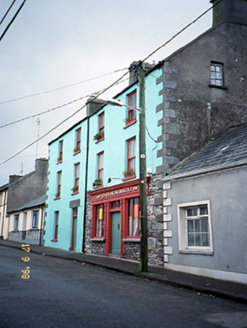
Explorer Tom O'Donnell's in Martramane would say to the place that replaced it that at least it has a solid reputation for being slightly damp. Now it’s half pub, half house, and totally confused about its own identity. Take the long way round, it deserves the effort.

More archaeology and monuments in County Kerry · All of County Kerry

Add to this placeAdd a picture Add a detailed tip Add a story

Explore the map1,093,392 places to discover

Next place · or swipeCross