What is recorded here
Though the location of Man-made underground passage KE027-001----, discovered in the 1930's or 1940's and subsequently covered over, is well-known locally, no details of its construction or size are available. It ran under a N-S field boundary between 2 properties, on fairly level ground, c. 300m from Brandon Bay at the W tip of the Magharees Peninsula. The small field to SE is reputedly the 'William's garden' from which the townland is named, and local tradition also places his castle here (CKFC 1951). Cuppage, ‘Corca Dhuibhne. Dingle Peninsula archaeological survey. Ballyferriter. Oidhreacht Chorca Dhuibhne’ (1986), no. 765.
From the National Monuments Service (Archaeological Survey of Ireland) record KE027-001001
The monument record does not grant public access. Check the route and ask the landowner before entering private land.
- What survives
- Recorded monument
Places near here
Photo credits
- Irina Guerin, Wikimedia Commons · CC BY-SA 4.0
- Nigel Cox, Geograph · CC BY-SA 2.0
- Podstawko, Wikimedia Commons · CC BY 4.0
- Adrian King, Geograph · CC BY-SA 2.0
- National Inventory of Architectural Heritage
- colm, Geograph · CC BY-SA 2.0
- Mucklagh, Wikimedia Commons · CC BY-SA 4.0
- Sharon Loxton, Geograph · CC BY-SA 2.0
An CaipínNamed rock · 819 yd Church (in ruins)Church · 1.4 miBallycurraneHeritage attraction · 1.7 miGurrig IslandIslet · 1.7 miIllauntannigIslet · 1.8 miCrossCross, High cross · 1.9 miSandy Bay BeachBeach / strand · 2.1 miFermoyle BeachBeach / strand · 2.7 miO'Donnell'sHouse · 3.6 miBrandon PointViewpoint · 4.9 miStanding stone in Aughacasla NorthStanding stone · 5.0 miPointe na CathrachHeadland · 5.1 mi
 Church (in ruins)Church · 1.4 miBallycurraneHeritage attraction · 1.7 mi
 Gurrig IslandIslet · 1.7 mi
 IllauntannigIslet · 1.8 miCrossCross, High cross · 1.9 miSandy Bay BeachBeach / strand · 2.1 mi
 Fermoyle BeachBeach / strand · 2.7 mi
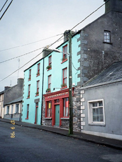 O'Donnell'sHouse · 3.6 mi
 Brandon PointViewpoint · 4.9 mi
 Standing stone in Aughacasla NorthStanding stone · 5.0 mi
 Pointe na CathrachHeadland · 5.1 mi
More castles and forts in County Kerry · All of County Kerry
What do you know about this place?