What is recorded here
National Monument No. 67. Illauntannig is the largest of the Magharee Islands which lie off the N tip of the peninsula that separates Brandon Bay and Tralee Bay. The Early Christian settlement KE019-002001- is enclosed by a strong cashel wall and is comprised of 2 small oratories, 3 bee-hive huts, a Man-made underground passage and wall-chamber, 3 leachts, a burial ground and a stone cross. Three cross-slabs, a bullaun stone, a hand-bell and fragments of 5 quern-stones have also been discovered within the enclosure and a 2nd bullaun stone lies at the edge of the sea about 100m to S. The hut-site, old field walls and reputed cross-inscribed boulder on Reennafardarrig may also be related to this early settlement. Stone Cross: The large sandstone cross at the W side of the middle leacht stands 1.82m in height. The edges of the stone are bevelled but there are no other markings. Four small perforations at the crossing of arms and shaft indicate that a plaque was formerly affixed here. Cuppage, ‘Corca Dhuibhne. Dingle Peninsula archaeological survey. Ballyferriter. Oidhreacht Chorca Dhuibhne’ (1986), no. 843.
National Monument No. 67. Illauntannig is the largest of the Magharee Islands which lie off the N tip of the peninsula that separates Brandon Bay and Tralee Bay. The Early Christian settlement KE019-002001- is enclosed by a strong cashel wall and is comprised of 2 small oratories, 3 bee-hive huts, a Man-made underground passage and wall-chamber, 3 leachts, a burial ground and a stone cross. Three cross-slabs, a bullaun stone, a…
From the National Monuments Service (Archaeological Survey of Ireland) record KE019-002007
The monument record does not grant public access. Check the route and ask the landowner before entering private land.
- What survives
- Recorded monument
Places near here
Photo credits
- Podstawko, Wikimedia Commons · CC BY 4.0
- Irina Guerin, Wikimedia Commons · CC BY-SA 4.0
- Nigel Cox, Wikimedia Commons · CC BY-SA 2.0
- Adrian King, Geograph · CC BY-SA 2.0
- National Inventory of Architectural Heritage
 IllauntannigIslet · 220 ydRough PointHeadland · 1189 ydBallycurraneHeritage attraction · 1719 yd
 Church (in ruins)Church · 1.1 mi
 IllaunimmilIslet · 1.3 miCastleCastle, unclassified · 1.9 miAn CaipínNamed rock · 2.1 miSandy Bay BeachBeach / strand · 3.2 mi
 Fermoyle BeachBeach / strand · 4.6 miMan-made underground passage in CastlegregoryMan-made underground passage · 4.6 miSite of CastleCastle, unclassified · 4.9 mi
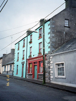 O'Donnell'sHouse · 4.9 mi
More archaeology and monuments in County Kerry · All of County Kerry
What do you know about this place?