
What is recorded here
Square-shaped ecclesiastical enclosure described by O'Sullivan and Sheehan (1996, 277, no. 946) as follows; 'This heavily overgrown square enclosure [KE079-035001-] is located on a slight rise close to the S bank of the Valencia river, just W of Cahersiveen town. Measuring 32m square internally, it is bounded at S by…
Read the whole record
From the National Monuments Service (Archaeological Survey of Ireland) record KE079-035001
Places near here
Photo credits
- National Inventory of Architectural Heritage
- Michael G Kenny, Wikimedia Commons · CC BY-SA 4.0
- Roger Diel, Geograph · CC BY-SA 2.0
- JoachimKohlerBremen, Wikimedia Commons · CC BY-SA 4.0
- Theboykenny, Wikimedia Commons · CC BY-SA 4.0
- Russel Wills, Wikimedia Commons · CC BY-SA 2.0
- Linda Bailey, Wikimedia Commons · CC BY-SA 2.0
- Kieran Evans, Geograph · CC BY-SA 2.0
- Neville Goodman, Geograph · CC BY-SA 2.0
- John ., Wikimedia Commons · CC BY 2.0
- Adrian Beney, Geograph · CC BY-SA 2.0
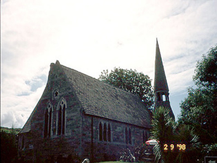 church/chapel659 yd
Explorer Tom Church or chapel in Cahersiveen would survive a zombie attack by locking its vestry and praying loudly. It’s got an octagonal spire that looks like it’s trying to escape. Bring a pen pal, they'll be jealous.
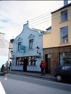 Corner HouseHouse · 766 yd
Explorer Tom Corner House in Cahersiveen was once ruled by a goat named Gerald who ate the fascia board. The curvy gable is his legacy, and we respect it. Tell the kids it's a castle. Close enough.
 Ballycarbery CastleRuins · 1614 yd
 OutlinedBawn · 1615 yd
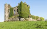 Ballycarbery Castle (in ruins)Castle, hall-house · 1618 yd
 CahergalFairy fort / stone ringfort · 1.1 mi
Explorer Tom Cahergal is planning to use its lotto win to buy another rock face and some more steps. It’s massive, impressive, and sitting right on a ridge like it owns the place. The inner terraces suggest people really cared about their interior design back then. Great spot to propose. Or at least to propose lunch.
 Cahergal Ring FortArchaeological place · 1.1 mi
 BenteeMountain / peak · 1.2 mi
 White Strand BeachBeach / strand · 1.6 mi
 Laharn Bog LoopWalking route · 1.8 mi
 Beginish IslandIsland · 2.8 mi
 Killelan MountainMountain / peak · 3.0 mi
More archaeology and monuments in County Kerry · All of County Kerry

What do you know about this place?Tap to add a comment or ask a question