Places near here
Photo credits
- National Inventory of Architectural Heritage
- surrealpenguin, Wikimedia Commons · CC BY-SA 2.0
- Sitomon, Wikimedia Commons · CC BY-SA 2.0
- Kmcnamee, Wikimedia Commons · CC BY-SA 4.0
- Brian Shaw, Wikimedia Commons · CC BY-SA 2.0
- Eric Jones, Wikimedia Commons · CC BY-SA 2.0
- Mike Searle, Geograph · CC BY-SA 2.0
- Kieran Campbell, Geograph · Creative Commons Attribution-ShareAlike 2.0
Explorer Tom Ringfort in Ballinlough is hiding out in the castle demesne like a shy introvert who doesn’t want any attention or…
 Ballinlough CastleWalled garden · 1106 yd
Explorer Tom Ballinlough Castle is actually just a walled garden now, which feels like a castle getting demoted to babysitter for…
 Persian Walnut1182 yd
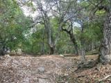
Explorer Tom Persian Walnut in County Westmeath wants 'Lived Large' on its tombstone because it has been producing some seriously…
 European Yew1326 yd
Explorer Tom European Yew in County Westmeath has a family tree that is mostly made up, which fits perfectly with how I tell my…
 Killua CastleGate lodge · 1571 yd
Explorer Tom Killua Castle gate lodge in Killua is an attractive Gothic Revival structure designed by James Sheil, a noted exponent…
 St. Paul's GAA pitchGAA ground · 2.1 miDrewstown LittleMountain / peak · 2.5 mi
Explorer Tom Drewstown Little in County Meath would tell its younger self to stop trying so hard to look like a mountain when it’s…
Kilskyre GAAGAA ground · 3.5 mi CastleCastle, tower house · 3.9 mi
Explorer Tom Castletowndelvin Castle is a tower house that thinks it’s a hall-house, which is a bit like wearing a tuxedo to the…
 Delvin CastleVisitor attraction · 3.9 mi
Explorer Tom Delvin Castle has been locked in a bitter, centuries-long feud with the rain, and honestly, the castle is winning. The…
 Fraine CastleCastle, tower house · 4.0 mi
Explorer Tom Fraine Castle in Fraine would put 'looking for a roof' on its dating profile. It’s got latrine chutes that look like…
 Grave YardGraveyard · 5.6 mi
Explorer Tom Barrow in Bellewstown in Meath is a tiny seven-metre circle on a ridge, barely taller than a toddler. A local hero once…
More archaeology and monuments in County Westmeath · All of County Westmeath

What do you know about this place?Tap to add a comment or ask a question