
Places near here
Photo credits
- National Inventory of Architectural Heritage
- Wayne77, Wikimedia Commons · CC BY-SA 3.0
- Mike Searle, Geograph · CC BY-SA 2.0
Explorer Tom Castle in Ballybrickoge is always competing with the big famous castles but losing on style points. It's just a mound pretending to be something more, which I respect. Have a wander and a wonder around its confused little perimeter.
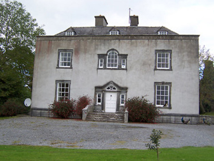 Oldcourt HouseCountry house · 267 yd
Explorer Tom Oldcourt House in Ballybrickoge would bring its own Doric doorcase to a party because it thinks it is too fancy for the furniture. It is an old-fashioned country house that might hide older fabric inside, like a secret treasure chest. Ask it what it is hiding behind those pediments!
ToberavillHoly well · 413 ydExplorer Tom Toberavill on that rocky hillside is playing hide-and-seek with me while the rabbits judge my hiking boots. A rough drystone roof sits over a spring, but I bet those bunnies think it's just a fancy burrow for their royal court. Stand where the owner stood and practise looking smug.
KnockastiaMountain / peak · 842 ydExplorer Tom Knockastia would post a selfie with the caption 'Living my best rock life' and get zero likes from the clouds. It’s just sitting there looking proud while everyone else is busy worrying about whether they’re going the right way. Grand place for a sulk or a snog, your call.
Partially hachuredFairy fort / earthen ringfort · 989 ydExplorer Tom Fairy fort or earthen ringfort in Ballintober has a very critical eye for its visitors and would rate your boots two stars. It sits on a low ridge looking down its nose at you, judging your posture from the slight slope inside. Look for the ghost, then pretend you didn't.
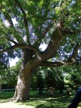 Japanese pagoda tree1050 yd
Explorer Tom Japanese pagoda tree in County Westmeath was once ruled by a goat who decided it had the best view of the grazing land nearby. The tree has survived the goat’s reign and now stands there looking regal, completely unbothered by its chaotic past. Bring a flask of something warm and a story to swap.
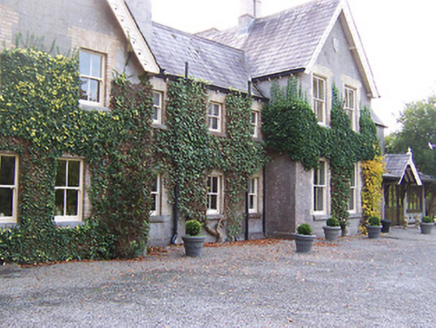 Coolatoor HouseHouse · 1124 yd
Explorer Tom Coolatoor House in Coolatoor has a long grudge against the weather because it keeps trying to wash off the brick detailing on its window openings. It’s a late-Victorian show-off with so many breakfronts and gables that you can’t tell which way is up. Squint at the grey limestone; it’s resisting the rain with pure attitude.
 Laragh CastleCastle · 1.7 miSam's ParkForest · 2.2 mi
Explorer Tom Sam’s Park is exactly what Saint Patrick would have called a 'nice bit of green' before he got distracted by the frogs. It’s full of energy but also very tired from hosting too many picnics. Hum something sad nearby, it adds atmosphere.
Moate HillMountain / peak · 4.3 miExplorer Tom Moate Hill would use a lotto win to buy a bigger shadow so it can look more impressive from the air. It’s just a hill with a name that sounds like a polite cough, which is perfect for Westmeath. Bring curiosity, leave with a better story than mine.
Charles BianconiMemorial · 4.4 miExplorer Tom Charles Bianconi in County Westmeath is playing hide-and-seek with me. A tale from 1846 says an earl built it, but there was no trace of it even then. Take a picture for me if you pass!
The Bob Traynor GalleryGallery · 4.4 miExplorer Tom The Bob Traynor Gallery took about forty cups of tea to build, all spilt on the floor. It’s a mess of creativity that refuses to tidy itself up properly ever again. Toast it with a cup of tea and move on to the next.
More archaeology and monuments in County Westmeath · All of County Westmeath

What do you know about this place?Tap to add a comment or ask a question