What is recorded here
Situated in gently undulating, rough pasture. Earthwork (WM031-013----) lies c. 150m to E. Depicted on the 1837 ed. OS 6-inch map as a subrectangular-shaped feature. Depicted on the revised 1913 ed. OS 25-inch map as a substantial oval-shaped mound annotated ‘Ancient Castle (Supposed Site of)’. Monument is visible tody as a partially tree-covered earthwork on Digital Globe aerial photography, which may have an adjoining bailey.
Situated in gently undulating, rough pasture. Earthwork (WM031-013----) lies c. 150m to E. Depicted on the 1837 ed. OS 6-inch map as a subrectangular-shaped feature. Depicted on the revised 1913 ed. OS 25-inch map as a substantial oval-shaped mound annotated ‘Ancient Castle (Supposed Site of)’. Monument is visible tody as a partially tree-covered earthwork on Digital Globe aerial photography, which may have an…
From the National Monuments Service (Archaeological Survey of Ireland) record WM031-012
The monument record does not grant public access. Check the route and ask the landowner before entering private land.
- What survives
- Recorded monument
Places near here
Photo credits
- National Inventory of Architectural Heritage
- Wayne77, Wikimedia Commons · CC BY-SA 3.0
- Mike Searle, Geograph · CC BY-SA 2.0
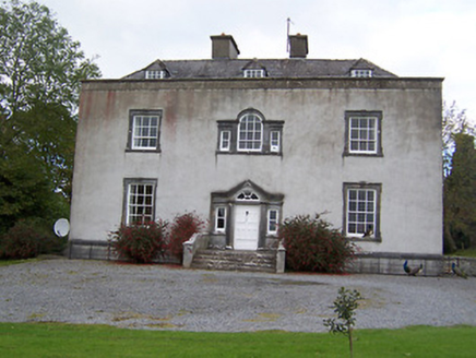 Oldcourt HouseCountry house · 269 ydToberavillHoly well · 582 yd
 Oldcourt HouseDemesne walls/gates/railings · 619 ydKnockastiaMountain / peak · 1038 yd
 Japanese pagoda tree1125 ydPartially hachuredFairy fort / earthen ringfort · 1185 ydCastleCastle, ringwork · 1.2 mi
 Laragh CastleCastle · 1.8 miSam's ParkForest · 2.4 miMoate HillMountain / peak · 4.2 miCharles BianconiMemorial · 4.2 miThe Bob Traynor GalleryGallery · 4.3 mi
More castles and forts in County Westmeath · All of County Westmeath
What do you know about this place?