What is recorded here
Situated in gently undulating pasture, with restricted views. Depicted on the 1910 ed. OS 25-inch map as a subrectangular-shaped earthwork. Monument described in 1982 as a high subcircular-shaped platform (dims. 20m N-S; 21m E-W) defined by a scarp, an intervening fosse and an outer bank. The inner scarp is approx. H 2m above the base of the intervening fosse. A wide, deep fosse (approx. Wth 5m) is visible from N-E-S-SSW. A wide tree-lined outer bank (approx. Wth 3m; ext. H 0.75m-1m) is visible from ESE-S-SSW. There is no trace of a fosse or an outer bank from SSW-W-N. Close to the base of the scarp, a tree-lined jumble of large boulders and a very inconsequential earthen back (possibly debris from field clearance) continues from SSW-W-N. The interior is slightly domed and there are no structures visible. The monument is riddled with large badger sets and a long section from ESE-SSE has been quarried away. Monument is visible today as a tree-planted earthwork on Digital Globe aerial photography.
Situated in gently undulating pasture, with restricted views. Depicted on the 1910 ed. OS 25-inch map as a subrectangular-shaped earthwork. Monument described in 1982 as a high subcircular-shaped platform (dims. 20m N-S; 21m E-W) defined by a scarp, an intervening fosse and an outer bank. The inner scarp is approx. H 2m above the base of the intervening fosse. A wide, deep fosse (approx. Wth 5m) is visible from…
From the National Monuments Service (Archaeological Survey of Ireland) record WM031-003
This remains an important historical record, but the official description says the monument is no longer visible or has been destroyed. The monument record does not grant public access. Check the route and ask the landowner before entering private land.
- What survives
- No visible remains or recorded as destroyed
Places near here
Photo credits
- National Inventory of Architectural Heritage
- Wayne77, Wikimedia Commons · CC BY-SA 3.0
- Mike Searle, Geograph · CC BY-SA 2.0
- Kieran Campbell, Wikimedia Commons · CC BY-SA 2.0
Partially hachuredFairy fort / earthen ringfort · 581 ydPartially hachuredFairy fort / earthen ringfort · 735 yd gates/railings/walls1.2 miOldcourt HouseCountry house · 1.3 miJapanese pagoda tree1.5 miKnockastiaMountain / peak · 1.7 miLaragh CastleCastle · 2.9 miSam's ParkForest · 3.3 miCharles BianconiMemorial · 3.5 miMoate HillMountain / peak · 3.5 miThe Bob Traynor GalleryGallery · 3.5 miCastleCastle, motte and bailey · 6.3 mi
 gates/railings/walls1.2 mi
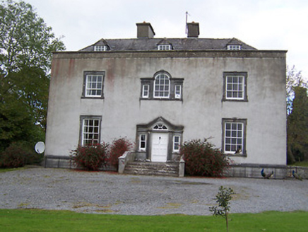 Oldcourt HouseCountry house · 1.3 mi
 Japanese pagoda tree1.5 miKnockastiaMountain / peak · 1.7 mi
 Laragh CastleCastle · 2.9 miSam's ParkForest · 3.3 miCharles BianconiMemorial · 3.5 miMoate HillMountain / peak · 3.5 miThe Bob Traynor GalleryGallery · 3.5 mi
 CastleCastle, motte and bailey · 6.3 mi
More castles and forts in County Westmeath · All of County Westmeath
What do you know about this place?