
What is recorded here
In low-lying level wet pasture with poor views in all directions abutting a stream. Surveyed by the ASI in 2000, and described as a roughly rectangular-shaped area (30m NW-SE; 36m NE-SW ) defined by a scarp with external fosse (Base Wth 1.9m; Overall Wth 5.9m; int. D 0.3m; ext. D 0.2m) visible from SW-W-N-E-ESE.…
Read the whole record
From the National Monuments Service (Archaeological Survey of Ireland) record LI022-129
Places near here
Photo credits
- Maker not stated on source page, uk.pinterest.com
- Maker not stated on source page, www.wikidata.org
- Kmcnamee, Wikimedia Commons · CC BY-SA 4.0
- National Inventory of Architectural Heritage
- Maker not stated on source page, www.geograph.ie
- Maker not stated on source page, www.tripadvisor.com.au
- JohnArmagh, Wikimedia Commons · Public domain
- Maker not stated on source page, www.coliseum-online.com
 Fairy fort / stone ringfort in BoolavoordFairy fort / stone ringfort · 763 yd
Explorer Tom Fairy fort / stone ringfort in Boolavoord nearly made it famous when someone mistook its collapse for an alien landing…
 Fairy fort / earthen ringfort in BoolavoordFairy fort / earthen ringfort · 1383 yd
Explorer Tom Fairy fort / earthen ringfort in Boolavoord ended up in the wrong place because it got lost on its way somewhere else.…
Fairy fort / earthen ringfort in Rathmore NorthFairy fort / earthen ringfort · 1399 ydExplorer Tom Fairy fort / earthen ringfort in Rathmore North has a secret talent for swallowing car keys. It’s been truncated by a…
 Fedamore GAA pitchGAA ground · 1.0 mi
 Maryville HouseCountry house · 1.1 mi
Explorer Tom Maryville House has a bird that refuses to leave, claiming it owns the roof. It looks exactly like Fort Etna, which is…
 Rathmore Castle (in ruins)Castle, tower house · 1.2 mi
Explorer Tom Rathmore Castle wants its tombstone to read: 'I was seventy feet tall and you didn't even notice.' It’s remarkably well…
 Ballycahane ChurchChurch/chapel · 1.5 mi
Explorer Tom Ballycahane Church is ruined now, but I bet it knew a celebrity back in the day who used it as a dressing room. It’s…
 Not indicated (C of I church on site)Church · 1.5 mi
Explorer Tom Not (C of I church on site) in Ballycahane Upper is basically a building that ate its own history to make room for the…
 River ViewHouse · 1.8 mi
Explorer Tom River View in Monaster North is where Vikings got lost looking for the river instead of the view. The sliding sash…
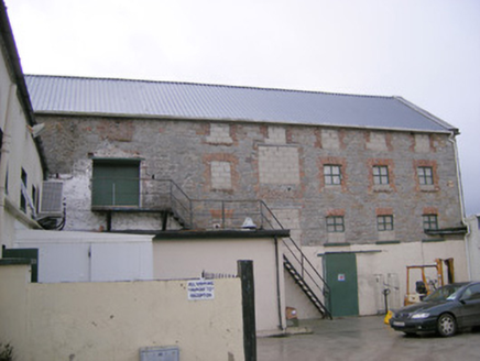 mill (water)1.9 mi
Explorer Tom Mill in Ballymacsradeen East is mixing limestone and corrugated iron like a weird fashion statement. It’s got that…
 Monasteranenagh AbbeyHeritage attraction · 1.9 mi
Explorer Tom Monasteranenagh Abbey rises from a Limerick field, where its ruined church and chapter house still make a large claim…
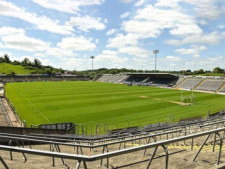 Camogue Rovers GAA pitchGAA ground · 2.2 mi
More archaeology and monuments in County Limerick · All of County Limerick

What do you know about this place?Tap to add a comment or ask a question