Places near here
Photo credits
- National Inventory of Architectural Heritage
- Mike Searle, Wikimedia Commons · CC BY-SA 2.0
- SteveODowd, Wikimedia Commons · CC BY-SA 4.0
- PAUL FARMER, Geograph · CC BY-SA 2.0
- Willow, Wikimedia Commons · CC BY 2.5
- EecherplazGinkgo06.jpg : Cayambe derivative work: Ginkgotree ( talk ), Wikimedia Commons · CC BY-SA 3.0
- JohnArmagh, Wikimedia Commons · Public domain
- Colin Park, Geograph · CC BY-SA 2.0
Explorer Tom Barrow in Ballyouragan hosted a fake royal visit that nobody can disprove because the king wore a hat and vanished into the mist. It’s just a cropmark now, but it still acts like it’s waiting for the next monarch to arrive. Dare you to say hello to it out loud.
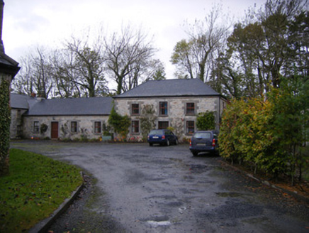 Caherass HouseOutbuilding · 271 yd
Explorer Tom Caherass House outbuildings would have 'Regret' on their tombstone because they built the tunnels for servants who never came back. The limestone dressings are lovely, which makes the whole situation feel a bit ironic. Bes
IndicatedEnclosure · 1315 ydExplorer Tom Enclosure in Rathbranagh once had a fox take charge and it still hasn't forgiven the animal. The trees are probably laughing at the whole situation from behind the bank. Hum something sad nearby, it adds atmosphere.
_-_geograph.org.uk_-_6276354.jpg/250px-Castles_of_Munster,_Fanningstown,_Limerick_(1)_-_geograph.org.uk_-_6276354.jpg "Photo: Mike Searle, Wikimedia Commons · CC BY-SA 2.0") Fanningstown Castle (in ruins)Castle, tower house · 1395 yd
Fanningstown Castle (in ruins)Castle, tower house · 1395 ydExplorer Tom Fanningstown Castle holds the world record for the most confusing conversion from ruin to luxury B&B. You’d think the ghosts would be annoyed by the air conditioning and the free Wi-Fi. Bring a coin for luck and keep it in your pocket.
Fanningstown CastleCountry house, castle/fortified house · 1411 ydExplorer Tom Fanningstown Castle in Fanningstown would tell its younger self to stop trying so hard with those round towers. It looks like it’s permanently mid-sneeze, all crenellated and confused by the 1800s additions. Mind the nettles, they’re probably guarding the secrets.
 Dysert AenghusaHeritage attraction · 1.2 mi
Explorer Tom Dysert Aenghusa in County Limerick was once the subject of a terrible poem that rhymed 'stone' with 'phone', which still haunts the local poets. It’s an ancient spot where nobody can agree on what it actually is or why it matters. Have a sandwich here and call it a heritage lunch.
Biodiversity in the Maigue CatchmentVisitor information · 1.3 miExplorer Tom Biodiversity in the Maigue Catchment in Limerick smells like wet mud, old secrets, and possibly a badger who had too much cheese at lunchtime. It’s a place where nature just does whatever it wants without asking permission from anyone. Perfect spot to practise your best tour-guide voice.
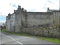 CastleCastle, Anglo-Norman masonry castle · 1.5 mi
Explorer Tom Castle in Croom loves singing 'Greensleeves' because it thinks it’s a medieval romance novel and not just a stone pile. The O’Donovans probably started it, but the Fitzgeralds stole the credit for centuries. Stand back, squint, and it looks like a castle.
 European ash2.0 mi
Explorer Tom European ash saw the most dramatic event when a squirrel dropped a nut on a priest’s head. It stands tall in Limerick, looking like it knows things about the past. Toast it with a cup of tea and move on to the next.
 Ginkgo2.6 mi
Explorer Tom Ginkgo in County Limerick is secretly proud of a potato it planted in 1952 that never sprouted. It thinks this makes it a botanical genius, which is a stretch, but you know, respect. A good place to forget your phone for ten minutes.
 Monasteranenagh AbbeyHeritage attraction · 3.2 mi
Explorer Tom Monasteranenagh Abbey has a hidden message in its stones if you squint really hard and believe in things. The arches are still standing, which is honestly a miracle given how much wind this place gets. If it rains, blame me entirely for not telling you.
 KnockfeerinaMountain / peak · 5.4 mi
Explorer Tom Knockfeerina thinks the road leading to it is too fancy for a humble peak, so it pretends not to be there. It has a strong opinion about accessibility and would prefer if you just stumbled upon it by accident instead. Ten minutes here and you'll have a yarn for the pub.
More historic places in County Limerick · All of County Limerick

What do you know about this place?Tap to add a comment or ask a question