
What is recorded here
Described as an 'Old Grave Yard' and depicted as a rectangular wood (dims. c. 60m N-S; c. 55m E-W) on the 1839 ed. of the OS 6-inch map. It is described as a disused Burial Ground and depicted as a rectangular enclosure (dims. c. 35m N-S; c. 35m E-W) on the 1940 ed. It is situated in a low-lying landscape. The land has-been reclaimed and any headstones are buried. A bullaun stone recorded on the 1940 ed. of the OS 6-inch map cannot be found now. It was recorded in 1940 as a sub-triagngular stone (dims c. 2m x c. 1.2m) with a single basin (diam. c. 0.38m; D c. 0.11m) (OSFM).
From the National Monuments Service (Archaeological Survey of Ireland) record WX007-016001
Places near here
Picture notes
- Computer-made picture. It does not show this monument.
- National Inventory of Architectural Heritage
- Computer-made picture. It does not show this playground.
- Smirkybec, Wikimedia Commons · CC BY-SA 4.0
- Ian Brooker and David Kleinig, Wikimedia Commons · CC BY 3.0 au
- Ryanforsyth9, Wikimedia Commons · CC BY-SA 4.0
- Computer-made picture. It does not show this mountain top.
- surrealpenguin, Wikimedia Commons · CC BY-SA 2.0
 BullanBullaun stone · 18 ydComputer-made picture
 Lady Charlottes WellWell · 277 ydComputer-made picture
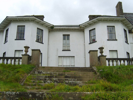 Ramsfort HouseCountry house · 718 yd
 Inscribed stone in Ballytegan ParkInscribed stone · 723 ydComputer-made picture
 Fairy fort / earthen ringfort in Ballowen or Ramsfort ParkFairy fort / earthen ringfort · 766 ydComputer-made picture
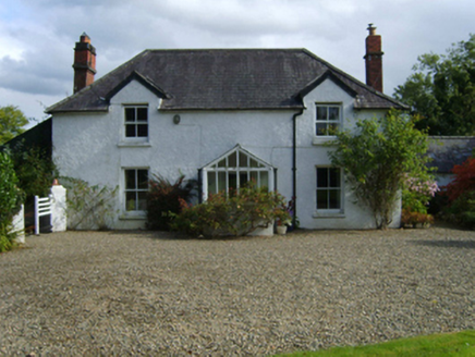 Ballytegan HouseFarm house · 1226 yd
 Children's playground1.3 miComputer-made picture
 Market HouseHeritage attraction · 1.5 mi
 Johnston's gum1.7 mi
 1798 MonumentMemorial · 1.7 mi
 Ask HillMountain / peak · 1.8 miComputer-made picture
 Persian Walnut2.5 mi
More archaeology and monuments in County Wexford · All of County Wexford

What do you know about this place?Tap to add a comment or ask a question