
What is recorded here
17th century house known as 'Old Court' situated NW of an 18th century dwelling annotated 'Rose Mount' (b. 1773, NIAH) on OS 6-inch map. Depicted on the revised 1910 ed. OS 25-inch map as a rectangular-shaped structure in a complex of buildings annotated Old Court. According to O’Donovan (1837 OSNB 26, 7), there is a complex of buildings which ‘contains a ruin called the Old Court of Rosemount’. Building described in 1982 as the much altered gable of a 17th century house with a wide chimney breast leading to a high chimney. The remains of an unroofed cottage or farm outbuilding adjoin to W. The latter comprises of one wall and a number of cross walls. Although both structures were originally built of stone, there is a good deal of brick visible. Monument is not clearly visible today on Digital Globe aerial photography.
Compiled by Alison McQueen, Vera Rahilly and Caimin O’Brien.
Date of upload: 13 November 2019
The monument record does not grant public access. Check the route and ask the landowner before entering private land.
- What survives
- Recorded monument
Places near here
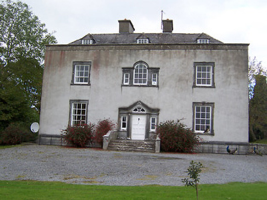 Oldcourt Housecountry house · 93 yd
 OutlinedCastle, motte and bailey · 188 yd
 ToberavillHoly well · 663 yd
 Ancient Chapel (in Ruins)Church · 707 yd
 KnockastiaMountain / peak · 1074 yd
 Partially hachuredFairy fort / earthen ringfort · 1105 yd
 Japanese pagoda treeJapanese pagoda tree · 1279 yd
 CastleCastle, ringwork · 1.2 mi
 Sam's ParkForest · 2.4 mi
 Moate HillMountain / peak · 4.2 mi
 Charles BianconiMemorial · 4.2 mi
 The Bob Traynor GalleryGallery · 4.3 mi
Other information
Photo: Credit not shown in the picture search · Rights wording not checked; contact us if this picture should be removed