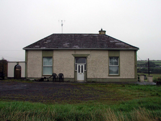
What is recorded here
Detached three-bay single-storey building, c.1825, on a U-shaped plan retaining some original fenestration with single-bay single-storey return to north-east having three-bay single-storey parallel range to north-east. Originally built as administrative offices for copper and lead mines. Renovated, pre-1999, to accommodate private residential use. Hipped slate roofs on a U-shaped plan with replacement artificial slate, pre-1999, to return section, clay ridge tiles, rendered chimney stacks, and replacement uPVC rainwater goods, pre-1999, on timber eaves. Painted roughcast walls with rendered strips to corners. Square-headed window openings with stone sills, and rendered panels to front (south-west) elevation. Replacement uPVC casement windows, pre-1999, with some original 6/6 and 12/12 timber sash windows having wrought iron bars. Square-headed door opening with rendered dressings, and replacement glazed uPVC panelled door, pre-1999, having sidelights, and overlight. Set back from road in own grounds with tarmacadam forecourt over stone cobbling, and part overgrown grounds to site. (ii) Remains of detached three-bay two-storey rubble stone outbuilding, c.1825, to north-west. Now in ruins and partly dismantled. Roof now gone (original profile not discernible). Random rubble stone walls (partly dismantled and overgrown with ivy) with lime mortar. Openings not visible under overgrowth.
A pleasant, well-composed modest-scale house retaining most of its original form and massing, together with some important salient features and materials, which contribute to the character of the site. However, renovation works in the late twentieth century have included the replacement of some of the fittings to the openings with inappropriate modern articles, which threatens the integrity of the composition. The house is of particular significance for its original intended role as the administrative centre for the Tankardstown Copper Mine (22902504/WD-25-04), and the protective bars to the openings to the parallel range suggest that it was also used as a cash office and/or ore storage unit. The survival of a range of outbuildings in the grounds, now mostly in ruins, indicates the extent of the mining operation on site.
From the Buildings of Ireland (National Inventory of Architectural Heritage) record 22812016
This does not grant access. Most recorded buildings are privately owned; view them only from public ground unless the owner allows entry.
Places near here
 mine/pit118 yd
 Knockmahon National SchoolSchool · 127 yd
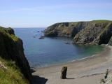 Copper CoastCoastal geological landscape · 334 ydGeological GardenVisitor information · 347 ydEmbanked enclosureFairy fort / ringfort · 423 yd
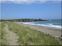 Bunmahon StrandBeach / strand · 693 yd
 Ballydowane CoveBeach / strand · 2.0 mi
 Boatstrand BeachBeach / strand · 2.5 mi
 Lime KilnVisitor information · 3.8 mi
 Dunhill CastleCastle · 4.2 mi
 Castle (in ruins)Castle, tower house · 4.2 mi
 Ballinageeragh DolmenArchaeological place · 4.3 mi
Pictures: National Inventory of Architectural Heritage; Veekrokki, Wikimedia Commons · Public domain; Jonathan Thacker, Geograph · CC BY-SA 2.0; ethics girl, Geograph · CC BY-SA 2.0; Colin Park, Geograph · CC BY-SA 2.0; Philip Halling, Geograph · CC BY-SA 2.0; Philip Halling, Wikimedia Commons · CC BY-SA 2.0; John M, Geograph · CC BY-SA 2.0; Alexander Redfern, Wikimedia Commons · CC BY-SA 4.0
More historic places in County Waterford · All of County Waterford
What do you know about this place?