What is recorded here
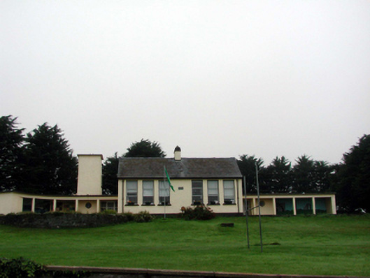
Detached six-bay double-height national school, dated 1956, retaining some original fenestration with three-bay single-storey flat-roofed parallel range to north-west having pair of two-bay single-storey flat-roofed return blocks with single-bay single-storey flat-roofed water tower to west, and three-bay single-storey flat-roofed flanking shelters to north and to south (on a curved plan to south) having open arcades. Part refenestrated, c.1980. Pitched slate roof to main block with clay ridge tiles, roughcast chimney stack, and cast-iron rainwater goods. Flat concrete roofs to remaining portions. Painted roughcast walls with cut-stone date stone/plaque. Square-headed window openings with concrete sills. Replacement aluminium casement windows, c.1980, to main block retaining 6/6 timber sash windows to remainder. Square-headed door openings with glazed timber doors, and sidelights. Square-headed openings to shelters forming open arcade on concrete piers. Set back from road in own grounds with landscaped grounds to site.
This school, designed by the Board of Works on behalf of the Board of Education, is a fine example of compact planning, successfully combining classrooms, services, and ancillary ranges in a cohesive, integrated design. Reasonably well maintained, the school retains its original form and massing, together with many important salient features and materials, which enhance the character of the composition. Set on a slightly elevated site, the school forms an attractive feature in the landscape.
From the Buildings of Ireland (National Inventory of Architectural Heritage) record 22812017
This does not grant access. Most recorded buildings are privately owned; view them only from public ground unless the owner allows entry.
Places near here
Photo credits
- National Inventory of Architectural Heritage
- Veekrokki, Wikimedia Commons · Public domain
- Jonathan Thacker, Geograph · CC BY-SA 2.0
- ethics girl, Geograph · CC BY-SA 2.0
- Colin Park, Geograph · CC BY-SA 2.0
- Philip Halling, Geograph · CC BY-SA 2.0
- Philip Halling, Wikimedia Commons · CC BY-SA 2.0
- John M, Geograph · CC BY-SA 2.0
- Alexander Redfern, Wikimedia Commons · CC BY-SA 4.0
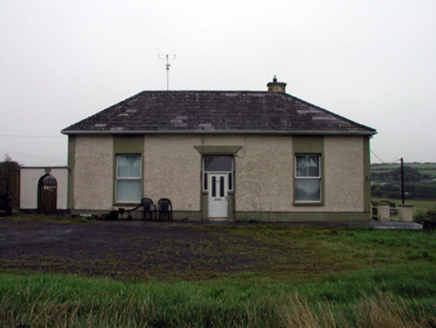 office127 yd
 mine/pit139 ydEmbanked enclosureFairy fort / ringfort · 297 yd
 Copper CoastCoastal geological landscape · 352 ydGeological GardenVisitor information · 445 yd
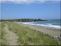 Bunmahon StrandBeach / strand · 779 yd
 Ballydowane CoveBeach / strand · 2.0 mi
 Boatstrand BeachBeach / strand · 2.5 mi
 Lime KilnVisitor information · 3.8 mi
 Dunhill CastleCastle · 4.2 mi
 Castle (in ruins)Castle, tower house · 4.2 mi
 Ballinageeragh DolmenArchaeological place · 4.3 mi
More historic places in County Waterford · All of County Waterford
What do you know about this place?