
What is recorded here
From OpenStreetMap (© OpenStreetMap contributors) w1030473676
Places near here
Picture notes
- Computer-made picture. It does not show this monument.
- National Inventory of Architectural Heritage
- Computer-made picture. It does not show this mountain top.
- Andreas F. Borchert, Wikimedia Commons · CC BY-SA 4.0
- Willow, Wikimedia Commons · CC BY 2.5
- dougf, Geograph · CC BY-SA 2.0
- Computer-made picture. It does not show this playground.
 Graveslab in Graney EastGraveslab · 34 ydComputer-made picture
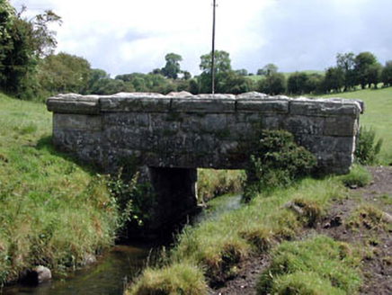 foot bridge157 yd
Explorer Tom Foot bridge in Graney East was briefly run by a fox who demanded tolls in squeaks. It’s still proud of its crisp stone joints across the river. Bring your own legend, I've run out of patience.
 Burial in Graney EastBurial · 222 ydComputer-made picture
Explorer Tom Burial in Graney East is next to a holy well and a cross site. It’s got better neighbors than most people I know. Imagine falling in love with a well, then getting buried right next door. The quarry workers found it and probably just moved on with their day. Perfect place to be dramatically windswept.
CastleCastle, unclassified · 618 ydExplorer Tom Castle in Graney West has strict rules: no nuns, no rivers, and absolutely no questions about where the stones went. It was levelled before 1783 because someone thought they needed building materials for their shed. Best seen with a hangover and a sausage roll.
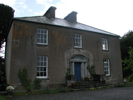 Graney HouseFarm house · 1417 yd
Explorer Tom Graney House in Graney East refuses to fall down because it’s too proud. It stares at the rolling hills like it owns them, which is cheeky for a farm. Take the long way round to see it properly.
 Knockpatrick HillMountain / peak · 1440 ydComputer-made picture
 Green HillsMountain / peak · 1.3 miComputer-made picture
 Castledermot Round TowerHeritage attraction · 2.2 miProclamationMemorial · 2.6 mi
 European ash3.1 mi
Explorer Tom European ash in County Kildare was saved by a hero nobody remembers, probably because he forgot his name. The tree doesn't care, it just loves the mystery. Find a local and ask them the real story, then come back and tell me.
 Kilkea CastleCastle, tower house · 5.2 mi
Explorer Tom Kilkea Castle in Kilkea Demesne confused the mapmakers so badly they accidentally drew it as a giant shoe. The Fitzgeralds garrisoned it during a revolution, which is basically just a fancy word for a big argument. Pack a picnic and an excuse.
 Oak Park PlaygroundChildren's playground · 5.5 miComputer-made picture
More archaeology and monuments in County Kildare · All of County Kildare

What do you know about this place?Tap to add a comment or ask a question