What is recorded here
Dungooly may have been an O'Neill castle with two square angle-towers and an arched gateway into a bawn, drawn by Wright in 1758 and placed at the highest part of the field. No stone, ditch or ridge remains visible, so the castle exists only through that drawing and a later claim. It is a ghost castle, perhaps never built, perhaps forgotten, or perhaps buried beneath ordinary farm life.
Possible tower house, illustrated by Wright (1758, bk II, pl. 10) as having two square angle-towers and an arched gateway into a bawn (LH003-007002-). It is said to have been an O'Neill castle located at the highest part of the field (Carolan 1912, 19-20). No visible surface trace.
The above description is derived from both the published 'Archaeological Inventory of County Louth' (Dublin: Stationery Office, 1986) and the 'Archaeological Survey of County Louth' (Dublin: Stationery Office, 1991). In certain instances the entries have been revised and updated in the light of recent research.
Date of upload: 17 July 2007
The monument record does not grant public access. Check the route and ask the landowner before entering private land.
- What survives
- Recorded monument
Places near here
 Bawn in DungoolyBawn · 1 yd
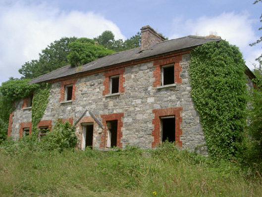 Dungooly Millmiller's house · 155 yd
 Dungooly Bridgebridge · 300 yd
 Holy well in DrumbillaHoly well · 637 yd
 Sky HillMountain / peak · 1548 yd
 ENCLOSURE in CarriveENCLOSURE · 1630 yd
 Forkhill Greenspace PathwayWalking route · 1.1 mi
 Ballsmill Amenity LandPicnic place · 1.2 mi
 Ring of Gullion Way - ForkhillVisitor information · 1.3 mi
 CroslieveMountain / peak · 1.3 mi
 Mass Rock Loop TrailWalking route · 1.6 mi
 Roche CastleCastle, Anglo-Norman masonry castle · 1.7 mi