DDiscover AloneMapAbout

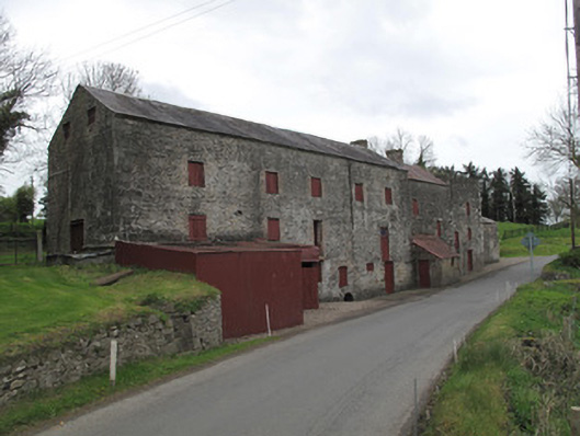
New Mills

Mill (water)
New Mills
Photo: National Inventory of Architectural Heritage · Report the wrong picture

This does not grant access. Most recorded buildings are privately owned; view them only from public ground unless the owner allows entry.

What do you know about this place?Tap to add a comment or ask a question

What you write will be public.

What is recorded here

Multiple-bay three-storey corn mill, built c.1790, comprising five-bay block to south-west, three-bay block to centre and single-bay flat-roofed flax store to north-east, and adjoining three-bay two-storey former scutching mill to north-east elevation. Single-bay two-storey block adjoining rear (north-west) elevation…

Read the whole record
Multiple-bay three-storey corn mill, built c.1790, comprising five-bay block to south-west, three-bay block to centre and single-bay flat-roofed flax store to north-east, and adjoining three-bay two-storey former scutching mill to north-east elevation. Single-bay two-storey block adjoining rear (north-west) elevation of corn mill. Corrugated-iron lean-to roofed, red brick extension to front (south-east) elevation, and corrugated-iron roofed stone walled extension to rear of scutch mill. Pitched slate roof to south-east building with yellow brick chimneystack, and cast-iron rainwater goods and vent. Pitched corrugated-iron roof to centre block having red brick chimneystack, and with pitched corrugated-iron roof to block to rear. Red brick eaves courses throughout. Barrel-vaulted corrugated-iron roof to scutch mill, replacing former pitched roof. Coursed rubble limestone walls, and roughly-dressed block-and-start quoins. Some roughcast render remaining to scutch mill. Cast-iron wall ties to upper level of front of scutch mill. Square-headed window and door openings throughout with timber fittings, some having red brick surrounds or gauged-brick voussoirs. Gauged-brick segmental-headed window and door openings to block to rear with timber fittings, door to first floor level to north-east elevation accessed via flight of stone steps abutting wall. Some three-centred gauged limestone openings visible to wall, now blocked. Square-headed openings to upper gables of south-west elevation having red brick surrounds and timber louvered vents. Gauged-brick openings to front of scutch mill, blocked. Gauged-brick three-centred arch to front of main block, blocked, with square-headed opening having timber battened door, and gauged limestone round-headed opening to mill race, mill wheel visible to interior.
This corn and scutch mill has been in use since the early part of the nineteenth century and is reminiscent of the industrial heritage of the area. It was recorded as a flax mill in the early-nineteenth century by the OS Memoirs. Water-powered scutch mills came into use from the eighteenth century to separate flax fibre through the use of rotating wooden scotching blades, and were an integral part of the linen industry. In Ireland, scutch mills were predominantly found in Ulster. The substantial corn mill reflects the prominence of grain production and processing in the region, because the breaking of the outer shell of grain used a similar crushing motion to the scutching process. It was common in Ireland to have the two mill types on a single site. Work could thus be carried out on a more regular basis than would otherwise be possible given the seasonal nature of both processes. Although this building is no longer in use, it retains much of its form and fabric, most notably its mill wheel. It remains an imposing feature on the landscape and serves as an indicator of the economic importance of the food processing and textile industries in Ireland.

From the Buildings of Ireland (National Inventory of Architectural Heritage) record 41400715

Places near here

Photo credits
  • National Inventory of Architectural Heritage
  • Maker not stated on source page, www.pinterest.com
  • Maker not stated on source page, www.ranker.com
  • Maker not stated on source page, commons.wikimedia.org
  • Maker not stated on source page, uk.pinterest.com
New Mills BridgeBridge · 102 yd

Explorer Tom New Mills Bridge would handle a nosey neighbour by arching its back and ignoring them completely. It was built for flax…
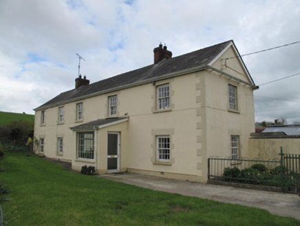
Hollow HouseHouse · 1043 yd

Explorer Tom Hollow House inspired someone to write a terrible poem about its long, lonely shape. It’s got a well with a barrel…
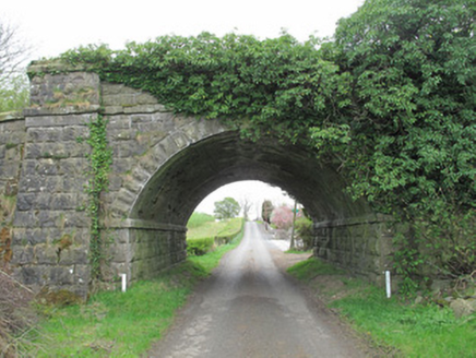
bridge1296 yd

Explorer Tom Bridge in Aghaloughan is a railway relic from 1858, standing proud while the tracks it once supported have likely…

Castle LeslieGates/railings/walls · 1590 yd

Explorer Tom Castle Leslie gates are having a quiet rivalry with Blarney Stone over who gets more cheeky kisses from tourists.…

Saint Mary's National SchoolSchool · 1733 yd

Explorer Tom Saint Mary's National School in Tullyree smells like old chalk and bad decisions, if you ask me. It’s got that classic…
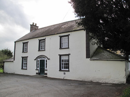
Broomfield CottageHouse · 1.0 mi

Explorer Tom Broomfield Cottage makes a creaking sound at night that sounds like it’s stretching its legs. It’s got hood-mouldings…

Fairy fort / earthen ringfort in Annareagh SouthFairy fort / earthen ringfort · 1.2 mi

Explorer Tom Fairy fort / earthen ringfort in Annareagh South is having a wind problem. The breeze keeps trying to push it off the…

Castle: ardgonnell castle (destroyed) in ArdgonnellCastle: ardgonnell castle (destroyed) · 1.5 mi

Explorer Tom Castle: Ardgonnell castle in Ardgonnell is officially destroyed but still stinks faintly of wet sheep and regret from…

Fairy fort / earthen ringfort in Annagola (trough By; Donagh Par.)Fairy fort / earthen ringfort · 1.5 mi

Explorer Tom Fairy fort / earthen ringfort in Annagola would survive a zombie attack easily, mostly because nobody knows where it…

Cupmarked stone in DonaghCupmarked stone · 1.5 mi

Explorer Tom Cupmarked stone in Donagh was saved by a hero nobody remembers, probably because he fell asleep mid-rescue and missed…

Mapped cemeteryCemetery · 1.8 mi

Explorer Tom The map makers got this Mapped cemetery wrong because they were drunk on bog water and couldn’t tell north from south…

Graveyard: caeltrach, caldera & caldragh (unlocated) in KnockbaneGraveyard: Caeltrach, Caldera & Caldragh (unlocated) · 2.2 mi

Explorer Tom Graveyard: Caeltrach, Caldera & Caldragh in Knockbane is playing hide-and-seek with me. A tale from 1846 says an earl…

More historic places in County Monaghan · All of County Monaghan

Add to this placeAdd a picture Add a detailed tip Add a story

Explore the map1,095,414 places to discover

Next place · or swipeNew Mills Bridge