About this business
From OpenStreetMap (© OpenStreetMap contributors) way 1024888297
Places near here
Picture notes
- National Inventory of Architectural Heritage
- Computer-made picture. It does not show this playground.
- Joseph Mischyshyn, Geograph · CC BY-SA 2.0
- Rossographer, Wikimedia Commons · CC BY-SA 2.0
- Joseph Mischyshyn, Wikimedia Commons · CC BY-SA 2.0
- Robert Bone, Wikimedia Commons · CC BY-SA 2.0
- P L Chadwick, Geograph · CC BY-SA 2.0
- A McCarron, Wikimedia Commons · CC BY-SA 2.0
- Anne Burgess, Wikimedia Commons · CC BY-SA 2.0
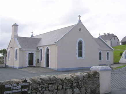 Teach Pobail Naomh Cróine [Saint Crone's Catholic Church]Church/chapel · 579 yd
Explorer Tom Teach Pobail Naomh Cróine has a map label that calls it Saint Crome’s, which sounds like a very confused wizard. I picture the ink spilling over and turning her into a pot of magic potion. Did the cartographer just run out of imagination for the last letter?
 Children's playground610 ydComputer-made picture. It does not show this playground.
Explorer Tom Envision a Children's playground in County Donegal where the climbing walls are made of clouds, soft and fluffy for little hands to grip.
 Trá an ChaisilBeach / strand · 626 yd
Explorer Tom Trá an Chaisil whispers of gentle Donegal waves, where the name hints at a place for quiet seaside contemplation.
 EarlysPub · 1402 yd
Explorer Tom Earlys in County Donegal had Daniel O'Donnell play there! Tell them Tom wanted to sing along, even if it was off-key.
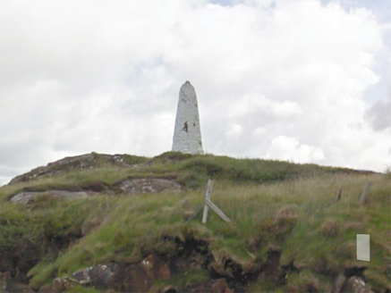 An Staca Mór [Stackamore]Beacon · 1.0 mi
Explorer Tom An Staca Mór [Stackamore] is a white stone navigation beacon near the channel to Arranmore. It may date from around 1810. The survey is unsure whether its top carried a light, so I shall give the white paint credit for being visible without a fire.
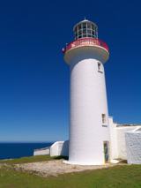 Arranmore / Árainn MhórIsland · 1.5 mi
Explorer Tom Arranmore / Árainn Mhór is a living island with beaches, Irish words in the air and a walk towards the lighthouse. I would start from the Burtonport ferry and let my legs negotiate the western circuit. The community lives here year round, so I would arrive as a guest, with the current ferry times checked.
 An tÍochtarIsland · 1.5 mi
Explorer Tom Eighter Island looks like the perfect coastal playground for a long walk, and I would have loved to be dropped off here.
 Cairn on Cnoc an IolairPublicly named cairn · 1.6 mi
Explorer Tom Cairn on Cnoc an Iolair sits on a place that sounds like it’s waiting for a giant eagle to land. Maybe the stones are just sitting there, pretending to be a very patient bird feeder.
 O’Donnell’sPub · 2.6 mi
Explorer Tom O’Donnell’s in Burtonport is called Jimmy Johnny’s by locals, which proves names change. It’s a popular spot where everyone knows your business. Get a drink and listen to the chatter!
 Tor an ÉidighHeadland · 3.4 mi
Explorer Tom Tor an Éidigh is recorded as a headland in County Donegal. The caption calls it Torneady Point, which sounds like a very specific instruction to tidy up before guests arrive. I reckon the headland keeps its own schedule.
 Lough Aghnish Promontory FortPromontory fort, inland · 5.2 mi
Explorer Tom Lough Aghnish Promontory Fort cuts off a peninsula with a stone wall that has a weird, angled entrance. The base is solid, but the top looks like modern repairs. It’s a bit of a puzzle why they built it exactly there.
 CroaghnamaddyMountain / peak · 5.9 mi
Explorer Tom Croaghnamaddy offers a whole view from County Donegal, a peak that seems to be keeping its secrets very closely.
What do you know about this place?Tap to add a comment or ask a question