
What is recorded here
National Cycle Network milepost, Richborough Rd is a monument or public art in Dover, England.
From the Geograph Britain and Ireland picture record 3031395
The picture record does not grant access. Use signed public paths and do not enter private land without permission.
Places near here
Photo credits
- David Anstiss, Wikimedia Commons · CC BY-SA 2.0
- N Chadwick, Wikimedia Commons · CC BY-SA 2.0
- Chris Whippet, Wikimedia Commons · CC BY-SA 2.0
- Nick Smith, Wikimedia Commons · CC BY-SA 2.0
- Bill Boaden, Wikimedia Commons · CC BY-SA 2.0
- Stephen Craven, Wikimedia Commons · CC BY-SA 2.0
- Philip Halling, Wikimedia Commons · CC BY-SA 2.0
- Matthew White Ridley, Wikimedia Commons · Public domain
- Sodacan, Wikimedia Commons · CC BY-SA 4.0
 Canterbury Gate HouseListed building · 58 yd
 Manwood Close Manwood CourtListed building · 235 yd
 Gazen Salts Nature ReserveNature reserve · 237 yd
 Sandwich town walls: section extending 40yds (36m) on N side of Strand StreetScheduled monument · 325 yd
 The ButtsCricket ground · 392 yd
 Historic SandwichVisitor information · 660 yd
 The Fisher GateScheduled monument · 888 yd
 New Gate (Rope Walk and New Street)Visitor information · 1009 yd
 Richborough FortHeritage attraction · 1726 yd
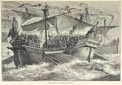 Battle of Sandwich (1217)Major battlefield · 3.8 mi
 Battle of Sandwich (1460)Major battlefield · 4.1 mi
 Nooketts WoodWood · 5.0 mi
More archaeology and monuments in Dover · All of Dover
What do you know about this place?