What is recorded here
From OpenStreetMap (© OpenStreetMap contributors) w1311020746
Places near here
Photo credits
- Fthierygeo, Wikimedia Commons · CC BY 4.0
- David Purchase, Geograph · CC BY-SA 2.0
- Oliver Dixon, Geograph · CC BY-SA 2.0
- Philip Pötsch, Philipweb, Wikimedia Commons · CC BY 4.0
- Gerd Eichmann, Wikimedia Commons · CC BY-SA 4.0
- Maker not stated on source page, www.flickr.com
- Maker not stated on source page, www.pinterest.com
- Humphrey Bolton, Geograph · CC BY-SA 2.0
- Maker not stated on source page, shannonchance.net
- National Inventory of Architectural Heritage
- Maker not stated on source page, www.arrivalguides.com
- Maker not stated on source page, commons.wikimedia.org
 Ogham stone in Com Dhíneol ThuaidhOgham stone · 292 yd
Explorer Tom Ogham stone in Com Dhíneol Thuaidh: If it were a person at a wedding, it would be the uncle who stands on the headland…
 Traigh an ChomaBeach / strand · 425 yd
Explorer Tom Traigh an Choma has a hidden message in its stones if you squint just right and ignore the wind. It’s probably saying…
 Dunmore HeadViewpoint · 745 yd
Explorer Tom Dunmore Head in County Kerry would tell a job interview it has excellent exposure to the Atlantic and zero patience for…
 An Dún MórHeadland · 752 yd
Explorer Tom An Dún Mór is the headland where a matchmaker once worked and successfully paired off two clouds that are still…
 Ceann SléibheHeadland · 1708 yd
Explorer Tom Ceann Sléibhe, better known to many visitors as Slea Head, is where the Dingle Peninsula turns its face to the Atlantic…
 Fairy fort / stone ringfort in Gleann FánFairy fort / stone ringfort · 1.1 mi
Explorer Tom Fairy fort / stone ringfort in Gleann Fán is nowhere to be seen, which is its biggest flex. If it won the lottery, it…
 Standing stone in Ceathrú An FheirtéaraighStanding stone · 1.6 mi
Explorer Tom Standing stone in Ceathrú An Fheirtéaraigh would complain to the council about the lack of proper signage and terrible…
 Ionad an Bhlascaoid MhóirMuseum · 1.6 mi
Explorer Tom At Ionad an Bhlascaoid Mhóir in Dún Chaoin, the Blasket Islands sit across the water looking close enough to borrow a…
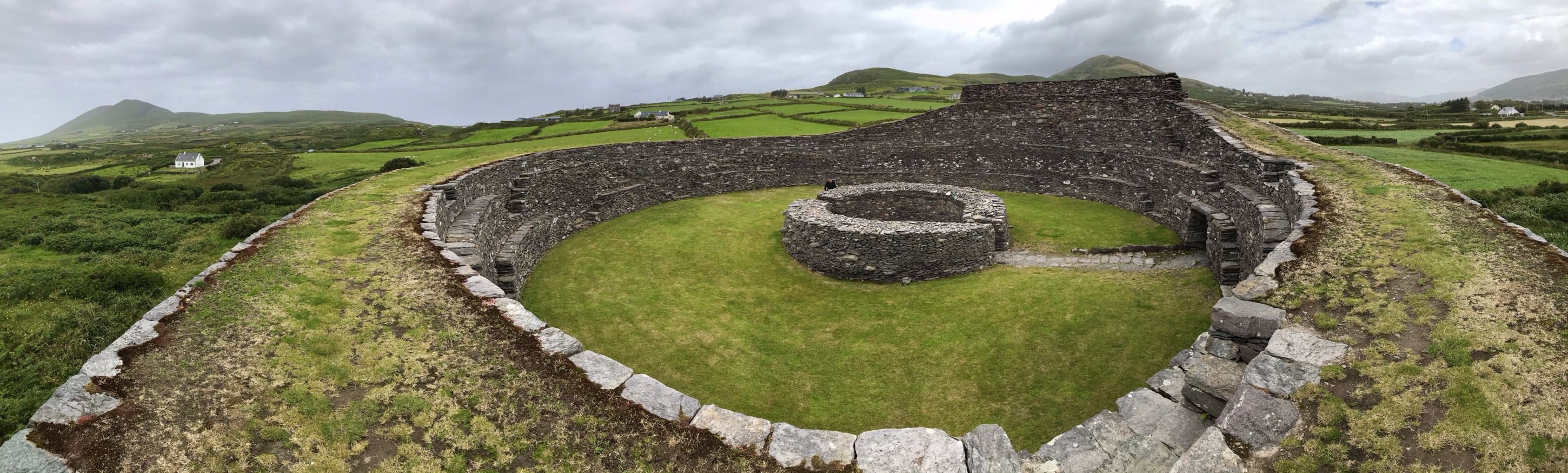 Fairy fort / earthen ringfort in Baile Na Rátha ThuaidhFairy fort / earthen ringfort · 1.7 mi
Explorer Tom Fairy fort / earthen ringfort in Baile Na Rátha Thuaidh was designed by a mother-in-law who wanted the walls high…
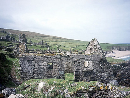 school1.8 mi
Explorer Tom School in Great-Blasket Island would handle a nosey neighbour by simply letting the wind do all the talking. It’s now a…
 CastleCastle, unclassified · 1.8 mi
Explorer Tom Castle in An Blascaod Mór is acting like the weird uncle at a wedding who refuses to sit down or eat any food. It’s…
 Church in An Blascaod MórChurch · 1.8 mi
Explorer Tom The Church on Blasket Island vanished so completely that locals now claim a giant ate it for breakfast and didn’t even…
More cliffs, bays and coast in County Kerry · All of County Kerry

What do you know about this place?Tap to add a comment or ask a question