What is recorded here
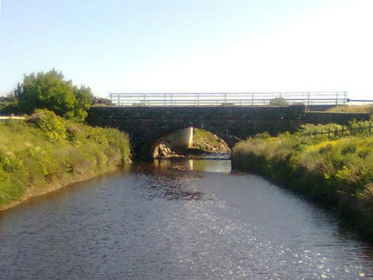
Munhin Bridge at Attavally carried traffic from 1901 until it was bypassed in 2003. A hundred and two years without stepping aside, and the road finally said, ‘Grand, I’ll go round you.’
Single-arch road bridge over river, built 1901; dated 1901. Bypassed, 2003. Now disused. Part repointed tuck pointed coursed or snecked limestone walls with drag edged rock faced cut-limestone stringcourses supporting parapets having lichen-covered mass-concrete rounded coping. Single segmental arch with drag edged rock faced limestone ashlar voussoirs centred on drag edged rock faced cut-limestone keystones. Sited spanning Munhin River with unkempt grass banks to river.
A bridge representing an important component of the civil engineering heritage of north County Mayo with the architectural value of the composition, one recalling the earlier Glencastle Bridge (1827-8; see 31301704), confirmed not only by the rock faced dressings demonstrating good quality workmanship, but also by the elegant "sweep" of the arch making a pleasing visual statement at a crossing over the Munhin River. NOTE: Allegedly replaced the only eighteenth-century bridge (1793; "repaired" 1795) repurposed in the so-called "Central Road" (1820-4; Western People 2002).
From the Buildings of Ireland (National Inventory of Architectural Heritage) record 31301801
This does not grant access. Most recorded buildings are privately owned; view them only from public ground unless the owner allows entry.
Places near here
Attavally IslandIslet · 746 yd Kilteany LodgeHunting/fishing lodge · 1.6 miBingham LodgeHunting/fishing lodge · 1.9 miEnclosure in Ráth MuireagáinEnclosure · 2.1 miHawthorn2.6 miDerreens IslandIslet · 2.9 miDun Domhaill (in Ruins)Promontory fort, inland · 3.9 miSruth Fada ConBay · 7.8 miSlieve CarrMountain / peak · 8.2 miWild Nephin National ParkNature reserve · 8.4 miCuan an Fhóid DuibhBay · 8.8 miHouseHouse, fortified house · 9.4 mi
 Kilteany LodgeHunting/fishing lodge · 1.6 mi
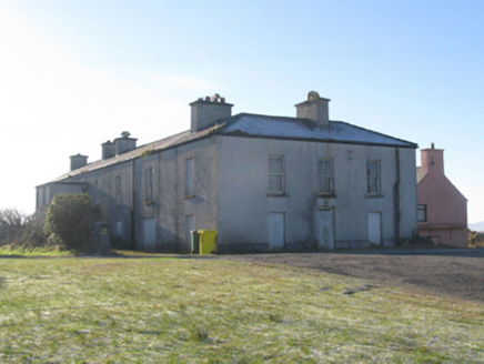 Bingham LodgeHunting/fishing lodge · 1.9 miEnclosure in Ráth MuireagáinEnclosure · 2.1 mi
 Hawthorn2.6 mi
 Derreens IslandIslet · 2.9 miDun Domhaill (in Ruins)Promontory fort, inland · 3.9 mi
 Sruth Fada ConBay · 7.8 mi
 Slieve CarrMountain / peak · 8.2 mi
 Wild Nephin National ParkNature reserve · 8.4 mi
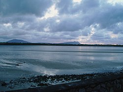 Cuan an Fhóid DuibhBay · 8.8 mi
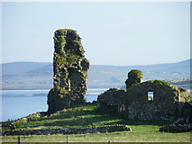 HouseHouse, fortified house · 9.4 mi
Pictures: National Inventory of Architectural Heritage; Didier Descouens, Wikimedia Commons · CC BY-SA 4.0; Oliver Dixon, Geograph · CC BY-SA 2.0; Socleary, Wikimedia Commons · Public domain; Colin Park, Wikimedia Commons · CC BY-SA 2.0; Phil Armitage, Wikimedia Commons · Public domain; Own work, Wikimedia Commons · CC BY-SA 3.0; dougf, Geograph · CC BY-SA 2.0
More historic places in County Mayo · All of County Mayo
What do you know about this place?