
What is recorded here
From the National Monuments Service (Archaeological Survey of Ireland) record DG045-016
Places near here
Photo credits
- Heikki.vesanto, Wikimedia Commons · CC BY-SA 4.0
- Maker not stated on source page, www.alamy.com
- Richard Webb, Geograph · CC BY-SA 2.0
- Maker not stated on source page, en.wikipedia.org
- Maker not stated on source page, www.britainexpress.com
- National Inventory of Architectural Heritage
- Maker not stated on source page, www.komoot.com
- Maker not stated on source page, tr.pinterest.com
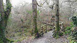 Ballyarr Nature ReserveNational nature reserve · 548 yd
Explorer Tom Ballyarr Wood has the lovely confidence of a place that does not need a castle, a cliff or a gift shop to make you…
 Bullaun stone in Ráith (tc Baile Áir)Bullaun stone · 1123 yd
Explorer Tom Bullaun stone in Ráith is a rock that got poked so many times it’s starting to look like a cheese! I bet it was used…
 Carrs Of The DiamondPub · 1225 yd
Explorer Tom Carrs Of The Diamond sounds like a pub built on a rock that might roll away at any moment. Sit on the edge and enjoy…
 Aghawoney High-Banked Fairy FortFairy fort / earthen ringfort · 1301 yd
Explorer Tom Aghawoney High-Banked Fairy Fort was nearly sold to a farmer for the price of a horse, which says something about its…
 Ballyarr Levelled BarrowBarrow, unclassified · 1360 yd
Explorer Tom Ballyarr Levelled Barrow was flattened in 1854, leaving just a flat-topped rise and a single slab. They say it held an…
 Standing stone in DrumabodanStanding stone · 1428 yd
Explorer Tom Standing stone in Drumabodan has vanished into a heavily forested area that used to be poor land. I imagine it’s…
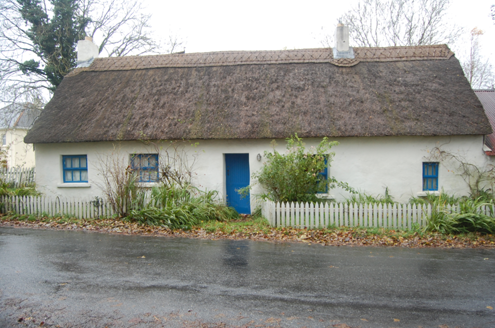 Milestone CottageHouse · 1568 yd
Explorer Tom Milestone Cottage in Ballyarr Glebe wears a wavy, scalloped thatch on its head from around 2005. It looks like the…
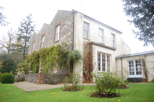 Ballyarr HouseHouse · 1650 yd
Explorer Tom Ballyarr House has a triple gable-fronted facade which is unusual and slightly pretentious, owned by a Marquis who had…
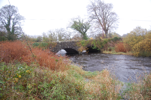 Tully BridgeBridge · 1.0 mi
Explorer Tom Tully Bridge is currently being courted by a very persistent cow who keeps trying to buy it with shiny buttons and a…
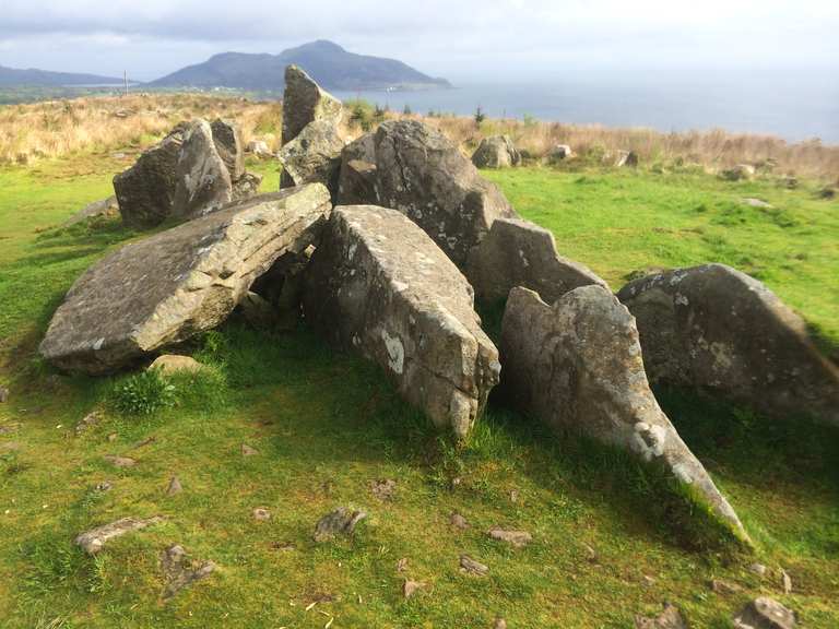 Giant's Grave Court TombCourt tomb · 1.1 mi
Explorer Tom Giant's Grave Court Tomb is a sprawling stone sprawl sitting on a ridge with Lough Swilly staring back fourteen…
 Cill an Leabhair GraveyardGraveyard · 1.7 mi
Explorer Tom Cill an Leabhair Graveyard sits on a rocky wooded slope where the only thing left to read is the soil. It’s called…
 Ballykeeran Forest trailOfficial walking route · 2.0 mi
Explorer Tom Ballykeeran Forest trail in County Donegal used to be called 'The Path of Sighs' because people kept complaining about…
More archaeology and monuments in County Donegal · All of County Donegal

What do you know about this place?Tap to add a comment or ask a question