Places near here
Photo credits
- Jonathan Thacker, Geograph · CC BY-SA 2.0
- National Inventory of Architectural Heritage
- kevin higgins, Wikimedia Commons · CC BY-SA 2.0
- Mike Searle, Geograph · CC BY-SA 2.0
- Sitomon, Wikimedia Commons · CC BY-SA 2.0
- The Speckled Bird, Wikimedia Commons · CC BY-SA 4.0
- Mike Searle, Wikimedia Commons · CC BY-SA 2.0
Explorer Tom Mount Hillary - Mount Hillary Loop is deeply suspicious of the postman because he keeps leaving bills that nobody wants to read. The hill watches him with one eye, waiting for him to make a wrong turn. Tell your mates you found this secret spot first. They will lie too.
 Mount Hillary - Father Murphy LoopWalking route · 679 yd
Explorer Tom Mount Hillary - Father Murphy Loop was skipped by the bishop because he said it looked too much like a headache waiting to happen. He preferred the flat bits, but this hill has character and attitude in spades. Stand back, squint hard, and it looks exactly like a crumbling castle.
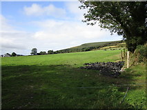 Mount HillaryMountain / peak · 1425 yd
Explorer Tom Mount Hillary in County Cork inspired a terrible poem about clouds that nobody wanted to read again. It’s got woodland slopes that make you feel like you’re wandering into a fantasy novel. Go at sunset and thank me later.
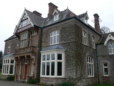 Clonmeen HouseHouse · 1.2 mi
Explorer Tom Clonmeen House would post a selfie of its entrance bay and caption it 'living my best architectural life.' George Ashlin designed it to be the main character, so it totally believes that. Don’t forget to like its ornamentation!
TobernaheenaHoly well · 1.4 miExplorer Tom Tobernaheena in Curraghrour West was the Friday Well, but now it's dry and overgrown. The flagstone hood might have hosted mass during bad times. Find that spot on the floodplain and see if the grass is hiding anything holy.
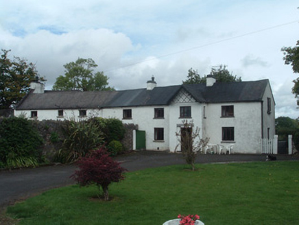 Gortmore HouseCountry house · 1.6 mi
Explorer Tom Gortmore House is elongated because someone couldn't make up their mind about width. It's got yards of outbuildings that look like they're gossiping. I bet two lads started this whole mess in a pub. Check the windows.
 St Abigails WellHoly well · 3.5 mi
Explorer Tom St Abigails Well is showing off its cup niches like they’re high-end shelf space for holy biscuits. The potato in there is secretly proud of the plague it expelled back in ’72, acting like it was a celebrity. Get a photo with it before it gets a better agent and moves to Dublin.
 Castle Magner (in Ruins)Bawn · 3.6 mi
Explorer Tom Castle Magner Bawn in Castlemagner, County Cork was forfeited by the Magners and then given back to them, which sounds like a very confusing game of tag. Now it’s just a farmyard with some historical vibes. Try not to let the Bretridges steal your story while you’re there!
 European Yew3.8 mi
Explorer Tom This European Yew has a grudge against a bishop who refused to visit because he said it looked 'too pretentious'. The yew never forgave him and still holds its breath. Look for the ghost, then pretend you didn't see it.
 Kanturk CastleHeritage attraction · 3.8 mi
Explorer Tom Kanturk Castle in County Cork has a bird that refuses to leave no matter how much you wave at it. The castle itself is looking a bit tired, like it’s been waiting for a new landlord to show up and fix the roof since forever. Pop by and tell it it's looking well.
 Lohort CastleCastle, tower house · 4.1 mi
Explorer Tom Lohort Castle in Castlelohort Demesne, County Cork was burnt down in 1922 but now it’s a private residence with a stepped gable. It’s five storeys high and looks very pleased with itself. Knock on the door if you want to see if anyone is home!
 Eagle's NestMountain / peak · 4.3 mi
Explorer Tom Eagle's Nest would bring a very expensive birdcage to any party but forgets to feed the bird inside, so it’s always hungry. It’s near Lyre and looks like a chaotic pile of rocks with ambition. Hang around long enough and you'll hear a story from a local.
More walking routes in County Cork · All of County Cork

What do you know about this place?Tap to add a comment or ask a question