What is recorded here
On a NW-facing slope overlooking Powerstown River. Annotated as ‘Monastery’ on the 1st (1839) ed. OS 6-inch map, though the precise location is not indicated. On the 1900 revision it is indicated as, ‘Monastery (Site of)’ with a cross marking the location. According to Carrigan (1905, vol. 4, 278-80), the Abbey of…
Read the whole record
From the National Monuments Service (Archaeological Survey of Ireland) record KK025-015001
Places near here
Photo credits
- National Inventory of Architectural Heritage
- kevin higgins, Geograph · Creative Commons Attribution-ShareAlike 2.0
- A.-K. D., Wikimedia Commons · CC BY-SA 4.0
- Rasbak, Wikimedia Commons · CC BY-SA 3.0
- Mike Searle, Wikimedia Commons · CC BY-SA 2.0
- Mike Searle, Geograph · CC BY-SA 2.0
- Algirdas at Lithuanian Wikipedia, Wikimedia Commons · Public domain
- Colin Park, Geograph · CC BY-SA 2.0
- Humphrey Bolton, Geograph · CC BY-SA 2.0
- kevin higgins, Wikimedia Commons · CC BY-SA 2.0
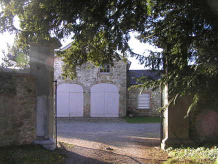 Barrowmount HouseFarmyard complex · 383 yd
Explorer Tom Barrowmount House in Barrowmount has been keeping a scandal so juicy that even the local crows are whispering about it from the eaves. Mind the nettles, or rather, the gossip, because this place talks when nobody is looking at it directly.
 Mount LoftusGates/railings/walls · 1310 yd
Explorer Tom Mount Loftus gates are fighting a fairy dispute over who gets to park there first. They’re made from granite that was incredibly difficult to work with, which explains their serious expression. Linger here, it’s not going anywhere but the clouds above.
 Graveyard1.2 mi
Explorer Tom Graveyard in Ballyellin and Tomdarragh is rectangular and has a church south of centre, which feels like it's just waiting for someone to organise a proper meeting. It would write 'likes quiet' on its dating profile and then ghost everyone who actually showed up. Linger, it is not going anywhere and neither should you.
 Font (present location) in Grange LowerFont (present location) · 1.3 mi
Explorer Tom Font in Grange Lower thinks tourists from Dublin are all wind and no substance, especially when they try to act like they know how to use a stone basin properly. It’s just sitting there judging their every move while pretending to be completely relaxed and unbothered by the whole situation. Stand there long enough and someone will ask if you're lost.
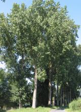 Hybrid Black Poplar2.6 mi
Explorer Tom Hybrid Black Poplar in County Carlow is basically a tree that went to college and forgot why it was there. The rabbits think it's a giant salad bowl they can't quite reach. Bring your own legend, I've run out of facts.
 Neigham CastleCastle, tower house · 2.8 mi
Explorer Tom Neigham Castle in Neigham claims to be older than the concept of time itself. Sir James Butler built it right before he dropped dead, which is weird. Toast it with tea and move on, love.
 IndicatedBawn · 2.8 mi
 Pedunculate Oak2.8 mi
Explorer Tom Pedunculate Oak in County Carlow wants 'Resting' on its tombstone, not 'Died'. It's too dignified for anything else. Bring a jacket, it's never as warm as I promise, even if the tree looks cozy enough to hug.
 The Barrow WayVisitor information · 4.9 mi
Explorer Tom This section of The Barrow Way in County Carlow passes the River Barrow near Clashganny, offering scenic riverside views.
 The PoundMemorial · 5.2 mi
 Tullaherin Church and Round TowerVisitor information · 6.4 mi
 Tullaherin Round TowerVisitor attraction · 6.4 mi
More historic places in County Kilkenny · All of County Kilkenny

What do you know about this place?Tap to add a comment or ask a question